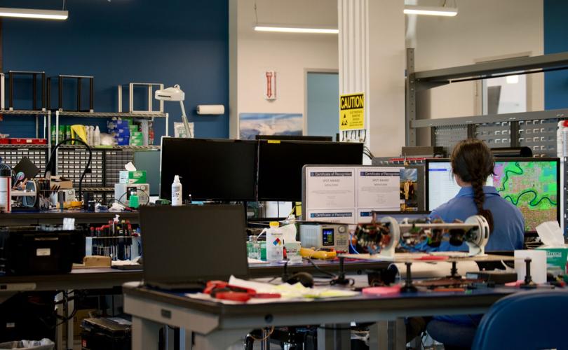
Overwatch Imaging’s design space, adjacent to Nichols Boast Basin in Hood River, where they build sensors with automated software destined to live beneath airplanes. Overwatch’s downward-looking TK sensor, one of two types they develop, is used for mapping applications like determining the perimeter of wildfires.
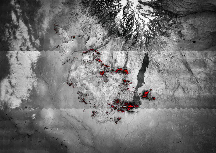
An infrared aerial image of the Williams Mine fire, which has burned just under 12,000 acres south of Mount Adams, captured by an Overwatch sensor earlier this month. The red areas correlate to heat and represent the most intensely burning parts of the fire.
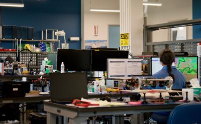
Overwatch Imaging’s design space, adjacent to Nichols Boast Basin in Hood River, where they build sensors with automated software destined to live beneath airplanes. Overwatch’s downward-looking TK sensor, one of two types they develop, is used for mapping applications like determining the perimeter of wildfires.
HOOD RIVER — “Every time I’m on a flight, I’m the kind of guy who’s just looking out the window the whole time,” said Greg Davis, the founder and CEO of Overwatch Imaging. “That bird’s eye view is something special that resonates with me.”
Since 2016, Davis and his team of 30 people have captured stunningly detailed, multispectral pictures from heights much higher than most birds can fly — around 30,000 feet. With its technology onboard planes from Spain to Australia, Overwatch Imaging plays a global role in national security, search and rescue missions and informing responses to wildfires, all from Hood River’s waterfront.
In simple terms, Overwatch builds sensors, or fancy cameras, that look for small things from far away and do so at a rapid pace. What sets the company apart, however, lies inside those sensors: By leveraging artificial intelligence, Overwatch’s sensors operate autonomously, moving back and forth beneath airplanes, stitching together thousands of images and providing feedback in real-time without human input. Such capabilities have all but revolutionized wildfire mapping.
“The old way, before Overwatch systems, was largely people in helicopters looking by eye,” as Davis explained, “and calling things out on radio to people on the ground.” Now, federal and state agencies, like the United States Forest Service or the California Department of Forestry and Fire Protection (CAL FIRE), have contracts with Overwatch and routinely fly planes with their technology over six to eight Western states.
In just one night, a single plane can collect data on 20 different wildfires, and then transmit that data to the appropriate incident command team before formulating their response plan at 6 a.m. every morning. Locally, Overwatch systems provided, or still provide, aerial images of the Microwave Tower, Whiskey Creek and Williams Mine fires.
An infrared aerial image of the Williams Mine fire, which has burned just under 12,000 acres south of Mount Adams, captured by an Overwatch sensor earlier this month. The red areas correlate to heat and represent the most intensely burning parts of the fire.
“As we look at the explosive growth of wildfires over the past decade or two, it’s clear to us that better data can lead to better outcomes,” said Davis.
Overwatch’s sensors can pick up several different spectral bands, or wavelengths of light, that communicate different information. Normal visible bands offer a snapshot of a wildfire, but thermal and infrared bands reveal where fires are burning the hottest, smoke patterns and even whether plants are still photosynthesizing, which correlates to fire severity. Through these images, Overwatch sensors and software can extrapolate an exact fire perimeter.
By assisting with immediate fire response, Overwatch is in the business of protecting public safety. “There’s a lot of technology jobs available for people in general, but I think the people who have chosen to work here really feel connected to making a big impact with their work,” said Davis.


Commented