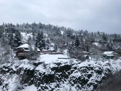
Hood River is experiencing what many throughout the Pacific Northwest are calling “Snowpocalypse 2019” and, while conditions are changing, it’s not necessarily for the better.
The National Weather Service said that today and tomorrow are “a difficult and dynamic weather forecast,” which Emergency Management Coordinator Barb Ayers said means “they can only guess, they are not sure about actual impacts.”
Rain and snow mix plagued the Hood River Valley on Monday, following a warm west wind that pushed in Sunday night. Slick conditions created dangerous road conditions in downtown Hood River and beyond, with police dispatch reporting semis blocking multiple streets and, briefly, exit 62 on I-84.
“There are significant road issues at most altitudes,” Ayers said. “Below, wet roads with partially frozen/melted snow on I-84, and up the valley with rain/snow mix, make travel difficult. The highest elevations have had continuous snow, with poor visibility.”
The National Weather Service predicts heavy, wet snow in Hood River Valley through Tuesday — between 12 and 18 inches in Hood River and up to 36 inches in Government Camp.
Snowfall is expected to decrease and become lighter on Wednesday. Meteorologists expect a 24-36 hour break Wednesday through Thursday, though there may be another storm on Thursday, according to the National Weather Service.
The concern now is that warmer temperatures could potentially cause some flooding, and folks should be aware of snow and ice melting off roofs.
“Currently, we are at the cusp of a warm front and cold front in Hood River, at river level, which has caused an unforecasted rain/snow mix at the valley floor and snow melt in the upper Hood River Valley,” said Ayers. “There is a flooding risk in low lying areas if rain or rapid snow melt persists. National Weather Service has issued a flood watch in low lying areas of Portland.”
Homeowners should also be wary of snow absorbing rain and becoming heavier, as that will significantly increase the snow load on roofs, Ayers said.
“Snow loads on roofs are now a concern,” she said, as the increased load could potentially cause cave-ins or collapse.
There is also a concern that trees could fall and cause power outages.
“Temperatures are hovering right near freezing, which means we could get rain or snow, melting or steady precipitation and dynamic conditions,” Ayers said. Rain and melted snow will likely freeze overnight, which, followed by even more snow, can make travel even worse.
A winter storm warning was in effect 6 a.m. Monday through 6 p.m. on Tuesday due to “severe weather conditions that (made) travel very hazardous or impossible,” the National Weather Service said. “If you must travel” during these conditions, they said, “keep an extra flashlight, food and water in your vehicle in case of an emergency.”
Vehicles are required to carry chains or traction tires on I-84 between Cascade Locks and The Dalles (mileposts 64-87); chains or traction tires are required on Highway 35 through Parkdale (mileposts 68-88.55); and oversized loads are prohibited on Washington State Route 14 from mileposts 83-153 until further notice.
Ayers said Monday afternoon, “… We’re already seeing significant challenges on all roads, specifically I-84 and Highway 35 today. Stay home if you can and off the roads, limit travel and go slow, use mobility traction if you must travel. Another round of heavy snow is forecasted tonight through Wednesday. Hood River remains firmly in winter’s embrace for Valentine’s day.”
For the latest road conditions in your area, call 5-1-1.



Commented