To guess this week’s photo, email florag@gorgenews.com or call 541-993-1801 and leave a message. Please be sure to spell your name, and any historical names you mention, in order to be credited properly on next week’s history page.
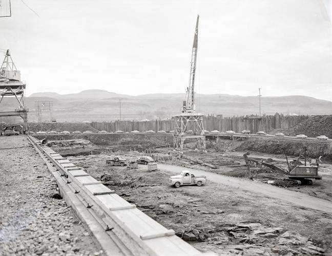
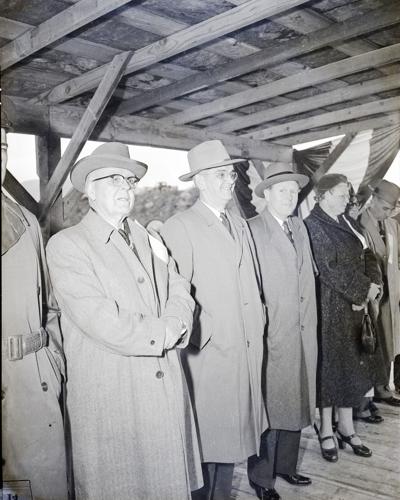
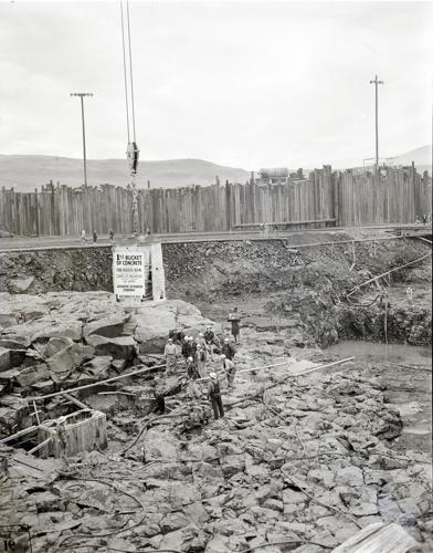
These images were scanned from black-and-white negatives in the archives of The Dalles Chronicle. Both were taken at a The Dalles-Dam related event in December 1953, as can be seen from the sign on the concrete bucket in the photo at left.
To guess this week’s photo, email florag@gorgenews.com or call 541-993-1801 and leave a message. Please be sure to spell your name, and any historical names you mention, in order to be credited properly on next week’s history page.
These images were scanned from black-and-white negatives in the archives of The Dalles Chronicle. Both were taken at a The Dalles-Dam related event in December 1953, as can be seen from the sign on the concrete bucket in the photo at left.
To guess this week’s photo, email florag@gorgenews.com or call 541-993-1801 and leave a message. Please be sure to spell your name, and any historical names you mention, in order to be credited properly on next week’s history page.
These images were scanned from black-and-white negatives in the archives of The Dalles Chronicle. Both were taken at a The Dalles-Dam related event in December 1953, as can be seen from the sign on the concrete bucket in the photo at left.
To guess this week’s photo, email florag@gorgenews.com or call 541-993-1801 and leave a message. Please be sure to spell your name, and any historical names you mention, in order to be credited properly on next week’s history page.
These images were scanned from black-and-white negatives in the archives of The Dalles Chronicle. Both were taken at a The Dalles-Dam related event in December 1953, as can be seen from the sign on the concrete bucket in the photo at left.
To guess this week’s photo, email florag@gorgenews.com or call 541-993-1801 and leave a message. Please be sure to spell your name, and any historical names you mention, in order to be credited properly on next week’s history page.
These images were scanned from black-and-white negatives in the archives of The Dalles Chronicle. Both were taken at a The Dalles-Dam related event in December 1953, as can be seen from the sign on the concrete bucket in the photo at left.
To guess this week’s photo, email florag@gorgenews.com or call 541-993-1801 and leave a message. Please be sure to spell your name, and any historical names you mention, in order to be credited properly on next week’s history page.
These images were scanned from black-and-white negatives in the archives of The Dalles Chronicle. Both were taken at a The Dalles-Dam related event in December 1953, as can be seen from the sign on the concrete bucket in the photo at left.
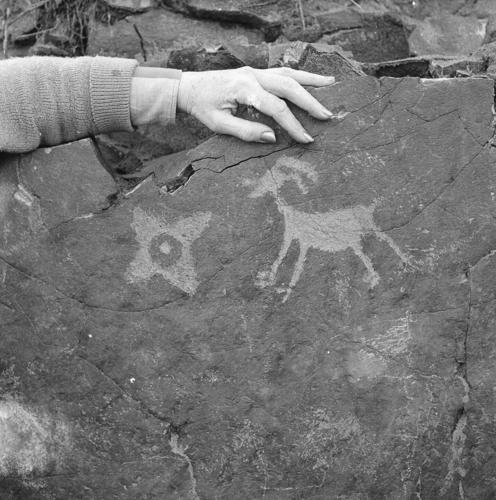
The envelope of this black-and-white negative, scanned from the archives of The Dalles Chronicle, reads "Petroglyphs, Lower John Day River, 1968."
The envelope of this black-and-white negative, scanned from the archives of The Dalles Chronicle, reads "Petroglyphs, Lower John Day River, 1968."
Rick McLure recognized last week’s photo of petroglyphs (shown above) on the lower John Day River.
“The photo depicts two petroglyphs, one of a mountain sheep, the other a four-pointed star,” he noted. “The petroglyphs are part of a larger site that includes many other Indigenous rock carvings, all of which were inundated following the construction of the John Day Dam. The site was located west of the original mouth of the John Day River, traditional territory of the Takšpašláma band, and currently within the ceded lands of the Confederated Tribes of the Warm Springs Reservation of Oregon. The same image in last week’s paper appears in the book “Pictographs and Petroglyphs of the Oregon Country, Part 1,” by Malcolm and Louise Loring, published in 1982 (p. 180). Documented by archaeologists with the River Basin Survey program in the early 1950s, and although now under water, the site is protected under Federal law.”
So far, these two images from last week’s paper are the only ones found in The Dalles Chronicle archives depicting this site.



Commented