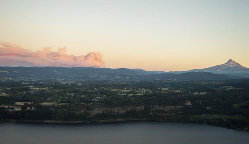
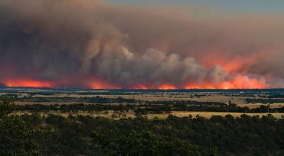
A smoke plume from the Grasshopper Fire, which ignited on July 23 and has largely burned in the Badger Creek Wilderness, rises far above the hills ensconcing the Hood River Valley on July 30, as seen from the Underwood Overlook.
Local residents gathered in South Wasco County High School’s cafeteria late on July 31 for a meeting about progress on the Grasshopper Fire, which included updates and statements of support from personnel with the Wasco County Sheriff’s Office, Oregon State Fire Marshal, Oregon Department of Forestry, United States Forest Service and California Interagency Management Team 6.
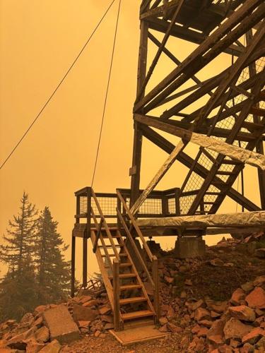
Smoke envelops the Flag Point Lookout on July 31. The site, which has been used to spot wildfires in the Mt. Hood National Forest since 1924, burned down last Saturday.
Photo courtesy of the United States Forest Service
The Grasshopper Fire calmed on Wednesday as crews continue to enhance structural protection and prepare for yet another shift in winds today
HOOD RIVER & WASCO COS. — Despite gusty northwest winds, the Grasshopper Fire grew by less than 1,500 acres yesterday, continuing a steady decline since the blaze consumed over 14,000 acres on Monday.
Beyond the six primary residences and 15 outbuildings identified yesterday, the Wasco County Sheriff’s Office (WSCO) has not released more information on structures lost to the fire. A total of 291 homes are currently under Level 3 “Go Now” notices while 1,561 homes are under Level 2 “Be Set” notices, which WSCO expanded on Monday and Tuesday due to the rapid growth.
The fire is now 85,114 acres large and remains 20% contained. Incident command is hosting a meeting tonight, beginning at 6 p.m. at Dufur School, to update residents on their efforts to corral the blaze.
Additionally, the Wasco County Fair board announced today that the 4-H and FFA livestock events will be held at the Hood River County Fairgrounds, beginning tomorrow. The board canceled the event amidst heightened fire risk on Tuesday, and is still working to reschedule the rodeo and demolition derby. Find this weekend’s schedule here.
As for the firefighting efforts, crews completed hand line and conducted strategic firing operations overnight to address unburned pockets of fuel and reduce the potential for continued fire spread near Rail Hollow Road yesterday, according to this morning’s operational update. Structural resources continued mopping up and securing areas around structures along Friend Road and in the Elliott Road area just south. Above the northern edge, previously completed hand line was plumbed with hose line near Camp Baldwin.
Moving to the southern edge, work strengthening containment lines was ongoing. In the southeast corner, crews expanded tactical patrol to Shadybrook Road and worked on structural protection plans should conditions change. In the southwest corner, firefighters continued building out indirect containment lines and heavy equipment helped improve access.
Thanks to felling operations and mop up efforts, Highway 35 along the western edge is open, but travelers should slow down and use caution while going through the corridor since personnel may still be working nearby.
Today, crews are preparing for yet another shift in weather, with east and northeast winds returning. An isolated thunderstorm threat near Cascade Crest along the western edge is possible, and afternoon smoke columns may be visible as the atmosphere grows more unstable.
The northeast finger also remains a priority. Crews plan to install dozer line near Elliot Road and will address any remaining heat or unburned fuels left by yesterday’s firing operations near Rail Hollow Road. Additionally, structural resources plan to expand mop-up operations around structures today, working up to 100 feet from homes impacted by the fire.
Tactical patrols will continue around structures from Fifteen Mile Road to Shadybrook. Additional structural crews will remain in Camp Baldwin, Sportsman’s Paradise and the Friend Road area, continuing mop-up and structure protection operations.
Homes burned by Grasshopper Fire and the Wasco County Fair is canceled, but growth slowed yesterday compared to explosive Monday.
HOOD RIVER & WASCO COS. — The Grasshopper Fire has burned at least six primary residences and 15 outbuildings, the Wasco County Sheriff’s Office (WCSO) confirmed this afternoon.
"Structural assessments will continue as conditions allow, and additional information will be shared as it is verified and appropriate for release,” reads WSCO’s Facebook announcement. "The delay in providing additional details is due to ongoing fire activity and the need to prioritize active fire suppression, firefighter safety, emergency access, and the protection of lives and property."
While WSCO did not clarify when the damage occurred, but beginning Monday afternoon, the fire’s top half made a significant wind-driven push east, spotting and spreading roughly four miles in one hour. Yesterday, the northeastern finger reached Hix Road, while the finger just south advanced to Elliot Road.
The Grasshopper Fire is now 83,642 acres large and 20% contained. It has consumed over 6,200 acres since yesterday morning — much less than the nearly 14,000 acres burned on Monday.
Task forces with the Oregon State Fire Marshal (OSFM) continue to engage in direct structure protection. Two additional task forces and a strike team of large structural engines from California arrived last night to bolster these efforts.
As of this morning, OSFM’s Blue Incident Management Team is in unified command with the Southern Area Blue Incident Management Team, and 1,832 total personnel are on scene.
Today’s focus is still on the fire’s highly active eastern portion as crews work to reinforce and tie together existing control lines. To the north, Forest Road 4421 is holding, as are the southern containment lines right above Pine Hollow.
Along Highway 35, felling operations helped mitigate significant overhead hazards yesterday, while crews continued mop-up along the western perimeter. Highway 35 is now open for travelers, but be wary of firefighters still working in the area.
Due to the fire danger and severe smoke, this year’s Wasco County Fair is also canceled, the fair board decided following an emergency meeting yesterday.
"Public safety is our top priority. While we share in your disappointment, the board will meet shortly to explore possibilities for hosting specific fair events at a later date. Thank you for your understanding and support,” reads a Facebook statement.
A community meeting is planned for Thursday, Aug. 12, but a time and place have yet to be announced. The Dalles Middle School is open for those who need shelter.
Most active day yet sees Grasshopper Fire grow by nearly 14,000 acres. Dufur and Tygh Valley have been placed under Level 2 evacuation orders, potential damage to residential structures hasn’t been confirmed and Mt. Hood Meadows is closed for the season.
HOOD RIVER & WASCO COS. — From Monday to Tuesday morning, the Grasshopper Fire consumed nearly 14,000 more acres — the most active 24-hour period since it was first reported on July 23 — prompting expanded evacuation orders in Wasco County.
Fueled by northwest winds, crews saw the fire’s top half repeatedly spot and spread east by roughly four miles in one hour yesterday afternoon, according to Operations Section Chief Anthony Rapoza with California Interagency Management Team 6. It moved through Shell Rock Road, over Heberlein Road and continued further into both the Larch Creek and Pine Creek drainages overnight.
“We have dozer line and hand line around that entire piece,” Rapoza said during today’s operational update, referring to the fire’s northeast finger. “First thing this morning, the priority for the fire is to get all of our folks back out there and begin to mop that up and secure those containment lines."
An incident management team with the Oregon State Fire Marshal, now in unified command with Team 6, returned yesterday afternoon, and task forces worked to strengthen structural protection throughout the Friend, Sportsman’s Paradise, and Camp Baldwin areas as the fire spread.
Rapoza noted the primary focus was on “life safety and pulling people out who needed to be evacuated or assisted” yesterday afternoon.
Virtually all areas south of Dufur Valley Road and above Pine Hollow, from the county line to the west and Highway 197 in the east, are now under Level 3 “Go Now” evacuation orders. Dufur and Tygh Valley are currently under a Level 2 “Be Set” notice, alongside several other areas.
For a map of Wasco County’s active evacuation orders, click here. The Dalles Middle School is open for those who need shelter.
It’s currently unclear what damage, if any, was sustained to residential structures by the recent activity. Columbia Gorge News has contacted Wasco County’s Emergency Manager, Sheridan McClellan, and will update this story as information becomes available.
In addition to the northeast finger, crews are prioritizing the northern flank today. Hand lines have been dug around every area where the fire slopped over Forest Road 4421, and crews continue to prepare Dufur Valley Road as an indirect contingency line.
The southern flank above Pine Hollow remains strong, as does Highway 35 along the west edge, but Mt. Hood Meadows announced this afternoon that it will be closed until ski season begins.
The resort has been under Level 3 evacuation orders since Aug. 4, as well as a forest closure mandated by the United States Forest Service.
"As a result, all Meadows-organized summer events have been cancelled, and we will be closing for the remainder of the summer,” reads the announcement made on Facebook. "We understand that this decision has a real impact on our guests, and especially our Team, and we want everyone to know we did not take this decision lightly."
Highway 35 is still closed between Parkdale and Bennett Pass Snow Park, but the road is open for nighttime travel, according to Meadows’ post.
The Grasshopper Fire is now 77,368 acres large and 20% contained, with 1,680 personnel mobilized in response. A new incident management team will assume command of the fire tomorrow morning with the Oregon State Fire Marshal.
‘Stubborn’ Grasshopper Fire burns more than 30,000 acres in the last week
A family walks along the Hood River Spit in thick smoke the evening of Aug. 3. Normally, you can see the Columbia River Gorge in the background.
Blaine Franger photo / special to Columbia Gorge News
HOOD RIVER & WASCO COS. — Last week, the Grasshopper Fire marched west, bringing hazardous air to Parkdale, forcing Mt. Hood Meadows to shut down and effectively encompassing most of the Badger Creek Wilderness until crews stopped it along Highway 35.
Between press deadlines on Aug. 3 and 10, the lightning-caused fire grew from 31,571 to 63,659 acres in size while containment rose by 4%, amounting to 23% incident wide. Last Monday, shifting winds from the east brought hotter, drier temperatures and a Red Flag warning the following day, which prompted expanded evacuation orders for the southeast corner of Hood River County.
From that point on, thick smoke blanketed the valley and a large swath of Wasco County, with air quality readings more than triple the hazardous threshold in some areas. Andrew Freeborn, public information officer for California Interagency Management Team 6, explained what that meant for more than 1,650 personnel now mobilized in response, including two hand crews from Oregon’s Air National Guard.
“When it gets real smoky and it’s poor visibility, that affects how much aircraft support we get,” he said. “But when we have a stable atmosphere, that means we’re all breathing in smoke and means a diminished fire intensity, so boots on the ground are able to engage right on that fire’s edge more effectively.”
“Everything in this fire is a tale of two stories: the weather, the fire progression, even how we fight the fire,” Freeborn added.
While crews made use of the east winds to strengthen southern containment lines near Pine Hollow, Sportsmans Park and Wamic, the fire pushed past Badger Butte, over Bennett Pass Road and was approaching Highway 35 by last Wednesday morning, subsequently spreading both north and south in the corridor. Winds from the west returned Thursday evening and improved air quality in Hood River County, but that brought another round of Red Flag conditions.
The Wasco County Sheriff’s Office then issued more evacuation orders, and Oregon’s Department of Transportation closed Highway 35 between Baseline Road and Bennett Pass Snow Park early Friday morning, which remains in place. The fire has not crossed Highway 35.
Crews leveraged Dufur Valley Road to prevent the fire’s northwest finger from inching closer to Parkdale, and on Friday, that finger merged with the fire’s main body as it once again turned east. Most of Saturday’s growth took place in the Fivemile Creek area and near the headwaters of Fifteenmile Creek as firing operations continued along Highway 35, which proved effective. The Red Flag warning expired at midnight.
On Sunday, resources assigned to the Grasshopper Fire provided initial-attack assistance to the Narrows, Mitchell and Austin fires on Clackamas County’s side of the Mt. Hood National Forest first reported on Aug. 8 and 9.
Mt. Hood Meadows evacuates
“We were ready for this,” said Greg Pack, general manager of Mt. Hood Meadows. “The team kicked in right away when we went to Level 3 and did all the securing we needed to do.”
On a typical summer weekday, camp counselors teach 90 kids about the mountain’s wildflowers and volcanology while other visitors hitch a lift to hike down the now green ski slopes. Smoke was severe enough that Meadows canceled its daily operations last Monday, Aug. 3, then the Hood River County Sheriff’s Office upgraded the resort’s Level 2 “Be Set” evacuation order, originally implemented July 31, on Tuesday.
Meadows has been closed since and now hosts a secondary fire camp alongside the primary one outside of Tygh Valley. Because it’s the most defensible, firefighters are sharing the parking lot with Meadows’ expensive heavy machinery, and the resort’s snowmakers are pointed at important assets like propane tanks. Sprinklers running around the buildings provide another layer of protection, as do strategically placed “water cubes,” Pack said.
Meadows also has its own wildland fire truck, and summer staff goes through wildland fire training every year. Additionally, task forces with the Oregon State Fire Marshal triaged every structure at Mt. Hood Meadows and the Cooper Spur Mountain Resort, should the Grasshopper Fire get close enough to pose a threat.
“We were taking pictures of flames from the ski area over on our side of Bennett Pass, which was kind of scary,” Pack said last Friday. “But as the crow flies, it’s still a few miles from us.”
Held east of Highway 35 as of press deadline, this is the closest a major fire has been to Mt. Hood Meadows since the Gumjuwac/Bluegrass Ridge Fire of 2006. Further west, Timberline Lodge was also under a Level 1 “Be Set” evacuation notice when Columbia Gorge News went to print.
Looking ahead
According to the incident meteorologist on Freeborn’s team, which is now in sole command of the Grasshopper Fire, temperatures will hover in the 80s this week and northwest winds should remain consistent until Thursday. Although there aren’t any Red Flag warnings in the immediate forecast, fire risk is still elevated.
“Even if we have more favorable weather conditions, the fact of the matter remains,” Freeborn said on Sunday. “Much of this forest and much of this vegetation is so dry that it doesn’t take really hot days, and it doesn’t take a lot of wind on it for it to be a really harsh firefight on the ground, so we don’t have an easy route through this fire.”
Sun sets in dense smoke with the trees of Underwood Mountain in the foreground on Aug. 3.
Blaine Franger photo / special to Columbia Gorge News
It’s all about building multiple levels of contingency lines, he emphasized. Along the northern perimeter, crews are not only directly engaged on the fire, but preparing Dufur Valley Road as a buffer and scouting beyond for additional holding opportunities. As for the fire’s southwest corner, crews are working on the Forest Road 4813 to the east, Wamic Road to the south and Forest Road 4911 to Pocket Creek as indirect fire line.
“We see how stubborn this fire is, how harsh the terrain is and this land that we’re fighting this fight in, so we’re not taking any chances,” said Freeborn. “We’re going to keep fighting this fire aggressively, and while we’re doing so, we’re going to keep putting up backup plans just in case.”
The United States Forest Service has closed 54 trails and more than two dozen roads because of the Grasshopper Fire. Click here for more information. Evacuation information for Hood River and Wasco counties is available here, and for more operational updates, visit the Grasshopper Fire’s Facebook page.
•••
Published on Aug. 6 at 11:05 a.m.
A shift in winds will help crews keep the Grasshopper Fire east of Highway 35 and improve air quality by tonight
HOOD RIVER & WASCO COS. — Crews have kept the Grasshopper Fire east of Highway 35, and with westerly winds returning, those efforts should be a little easier over the next few days.
Now 23% contained with 1,405 personnel mobilized in response, the Grasshopper Fire grew to 43,244 acres yesterday as its northwest finger neared the Level 2 evacuation zone for Mille Creek Buttes in Hood River County. Evacuation orders implemented on Aug. 4 remained unchanged, however, and the same goes for those in Wasco County.
For a map of Hood River County’s active evacuation orders, click here. Wasco County’s are available here.
"Wind shifts have reduced fire intensity along the west perimeter, creating favorable conditions to further strengthen containment lines along the Highway 35 corridor,” reads an operational report issued this morning. “Firefighters will reinforce suppression efforts near Pine Creek and across the northwest."
As structure triage is complete, the Oregon State Fire Marshal’s Incident Management Team and its remaining task force will demobilize today, leaving California Interagency Management Team 6 in command of the incident.
Air quality is hazardous in the Upper Hood River Valley, Pine Hollow and Dufur, according to current readings from Smoke Ready Gorge. Avoid outdoor activities and wear an N95 mask if possible. Hood River, The Dalles and Mosier range from unhealthy to very unhealthy air, with levels slightly lower across the river in White Salmon and Underwood.
The Mid-Columbia Community Action Council has masks, cooling supplies and available at both of its offices in Hood River and The Dalles.
Yesterday, firefighters continued mop up operations along the eastern edge of the fire, and the southern edge is holding strong. Along the north side, crews made steady progress tying together northwestern and northeastern control lines to strengthen containment. On the western flank, resources worked to advance north to improve long-term control of the fire's northwest corner.
The Grasshopper Fire grew nearly 5,000 acres on Tuesday while evacuation orders remain unchanged and air quality worsens
HOOD RIVER & WASCO COS. — Fueled by winds from the east, the Grasshopper Fire has continued crawling into Hood River County, nearly reaching Highway 35.
The lightning-caused fire grew to 39,439 acres in size yesterday, and today, crews expect the northwestern edge to move toward Bennett Pass and the Badger Bowl area. Fire intensity will likely decrease as it nears the Highway 35 corridor, according to an operational report from California Incident Management Team 6 and the Oregon State Fire Marshal, which assumed joint command of the fire last Wednesday.
As of right now, Highway 35 remains open to travelers, and the Level 3 “Go Now” evacuation orders issued yesterday for the southeast corner of Hood River County are unchanged. This includes Mt. Hood Meadows, Elk Mountain and Tamawanas Falls. White River, a large portion of Cooper Spur Road and Mill Creek Buttes are still under Level 2 orders.
For a map of Hood River County’s active evacuation orders, click here. Wasco County’s are available here. Before traveling, consult Oregon TripCheck to see if any closures impact your route.
Air quality throughout the mid-Columbia is unhealthy to hazardous because of smoke from the Grasshopper Fire, and the larger shift in winds from west to east that began Monday morning. For more information, see this story from Columbia Gorge News.
On the ground, crews will continue suppression operations along Forest Roads 45 and 50 east of Highway 35. Structural task forces are still triaging buildings on the fire’s west side, and containment lines along the fire’s southern edge near Pine Hollow, Sportsmans Park and Wamic look strong. Overall, the fire is 20% contained.
"Winds will be lighter today but remain easterly with hotter, drier conditions. A shift to westerly winds is expected from mid-afternoon to early evening, reducing fire spread potential toward the Highway 35 corridor,” reads the report.
Mt. Hood Meadows, Tamawanas Falls and a large swath of southeast Hood River County under Level 3 evacuation orders as winds push the Grasshopper Fire west
WASCO & HOOD RIVER COS. — Between Sunday night and Monday night, the Grasshopper Fire grew by just over 3,000 acres as winds shifted from east to west, triggering new evacuation orders in Hood River County.
As of Tuesday morning, the lightning-caused blaze was 34,659 acres in size and 19% contained. While Pine Hollow, Sportmans Park and Wamic all saw their evacuation orders reduced from Level 3 to Level 2 yesterday afternoon, “Go Now” orders are active on both sides of Highway 35, including at Mt. Hood Meadows.
On the east side of the highway, orders stretch from Forest Road 44 down to the county’s southeast corner, encompassing Badger Butte, Bennett Pass, and Lookout Mountain. Orders for the west side begin where Cooper Spur Road intersects with Highway 35 and continue south to milepost 63, covering Elk Mountain, Tamawanas Falls and Hood River Meadows as well.
"Crews will continue efforts in the northwest to address increased fire activity and reinforce contingency features ahead of anticipated weather,” reads an operational update from this morning. "Increased fire activity may impact the Highway 35 corridor."
The National Weather Service has issued a Red Flag warning for the western Columbia Gorge from this afternoon through Wednesday evening, anticipating dry conditions and easterly winds up to 38 miles per hour.
White River, Mill Creek Buttes and a large section of Cooper Spur Road, including Cooper Spur Ski Resort, are under Level 2 “Be Set” evacuation orders. The Level 1 zone stops just short of Parkdale proper.
For a map of Hood River County’s evacuation orders, click here. Active orders in Wasco County can be found here.
Additionally, Oregon’s Department of Environmental Quality has issued an air quality advisory for southern Wasco County, in effect until rescinded, and current readings show that air quality is unhealthy across Hood River County.
California Interagency Management Team 6 and the Oregon State Fire Marshal are jointly managing the Grasshopper Fire, with 1,264 personnel on scene this morning. Alongside efforts closer to Highway 35, crews will continue to reinforce containment lines along the fire’s southern edge and further bolster preparations in the Jordan Creek area to hold the northern perimeter.
Despite losing the Flag Point Lookout, crews successfully navigated a blustery Red Flag period on Saturday and saw containment numbers increase Monday morning
A smoke plume from the Grasshopper Fire, which ignited on July 23 and has largely burned in the Badger Creek Wilderness, rises far above the hills ensconcing the Hood River Valley on July 30, as seen from the Underwood Overlook.
Nathan Wilson photo
WASCO CO. — After a significant test this weekend, the Grasshopper Fire, burning just north of Pine Hollow, Sportsmans Park and Wamic, grew, but only slightly, and crews are hopeful that it represents a turning point.
“If we keep holding like we’ve seen here, we’re trending in a really positive direction,” said Andrew Freeborn, public information officer for California Interagency Management Team 6, during an Aug. 2 interview. “We’re not out of the woods yet, but it feels like we’re about to get some reward and get some containment numbers boosted up from all the hard work that’s been done.”
And they did. As of press deadline on Monday morning, the Grasshopper Fire was 17% contained with 1,244 personnel on scene and 31,571 acres burned, primarily in the Badger Creek Wildnerness. Evacuation orders for the Pine Hollow area dropped to Level 2 that morning as well. Freeborn’s crew took command of the fire, which was sparked by lightning on July 23, last Wednesday with the Oregon State Fire Marshal.
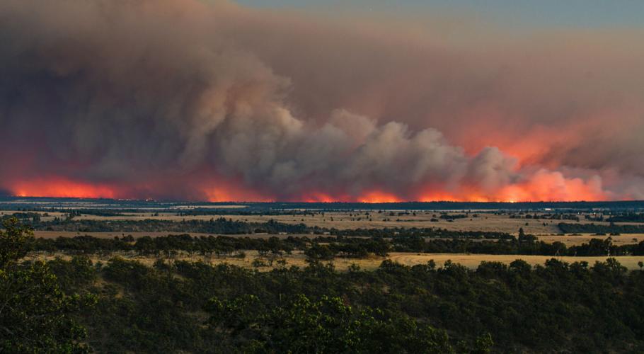
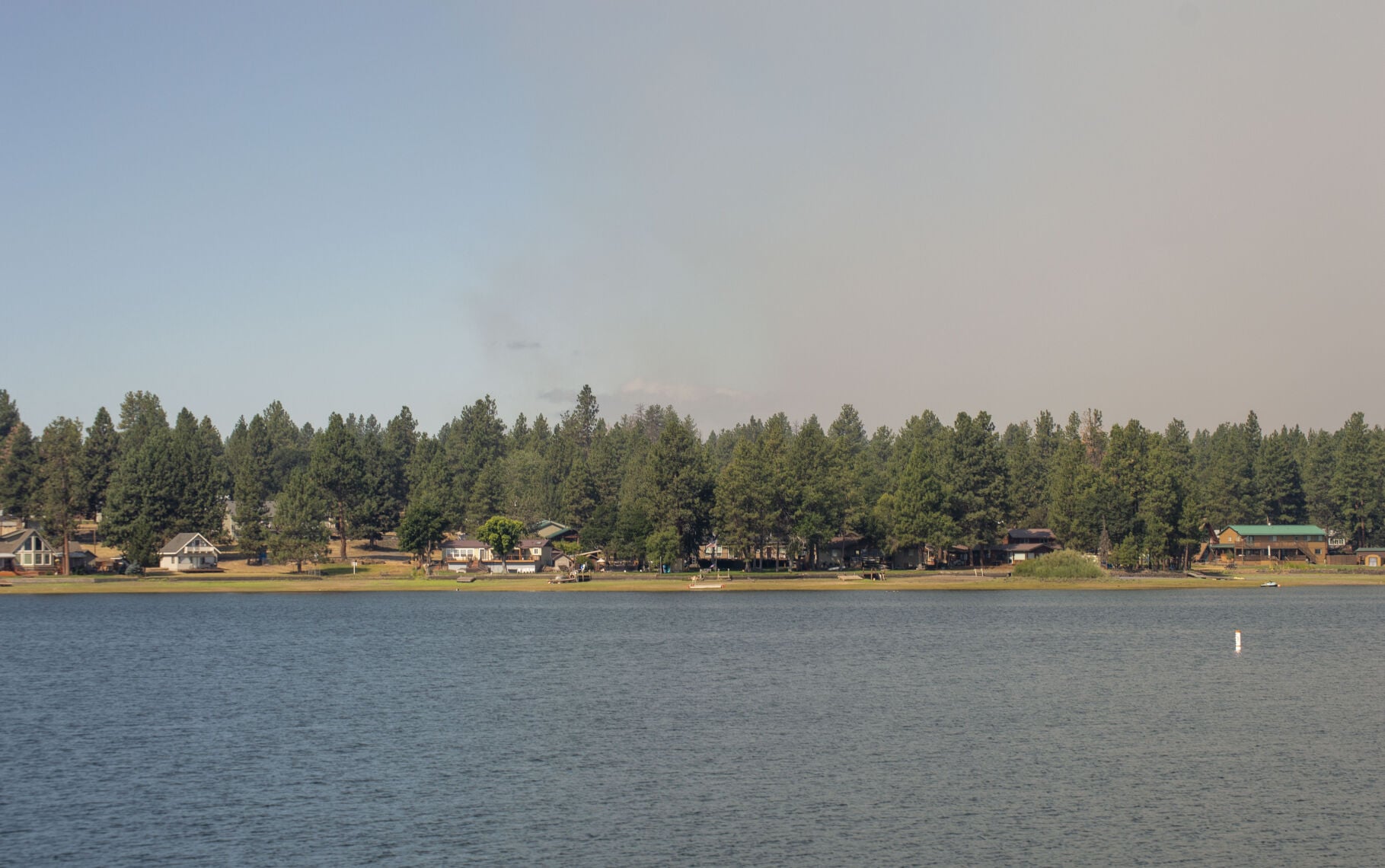
Smoke from the lightning-caused Grasshopper Fire hangs over Pine Hollow Reservoir early on July 28.
Nathan Wilson photo
During a community meeting two days later on July 31, operations leadership and local residents braced for a strong wind event. The incident meteorologist projected 30-35 mile-per-hour westerly gusts from 11 a.m. to 11 p.m. on Saturday as a cold front came over the Cascades, triggering a Red Flag warning for most of Eastern Oregon.
But control lines along the fire’s southwest corner and edge nearest Pine Hollow, didn’t budge. The northeast corner, however, saw slopover off Forest Road 27 and a spot fire heading toward Friend that crews were able to halt at roughly 400 acres burned.
And while no residential structures have reportedly been impacted yet, the Flag Point Lookout went up in flames on Saturday, despite prior fuels reduction work and fire retardant. The site, reconstructed in 1973, had been used to spot wildfires since 1924.
Smoke envelops the Flag Point Lookout on July 31. The site, which has been used to spot wildfires in the Mt. Hood National Forest since 1924, burned down last Saturday.
Photo courtesy of the United States Forest Service
“Flag Point has long been an important part of the Mt. Hood National Forest and holds a special place for many members of the surrounding communities,” reads a press release from the United States Forest Service. “Firefighters remained engaged in structure protection operations as long as conditions allowed.”
Critical radio infrastructure on Flag Point, used by Wasco County, the Forest Service and other agencies, wasn’t damaged.
With a reprieve from the strong winds on Sunday, crews focused on building control lines around the Forest Road 27 slopover and indirect lines above the fire’s northern edge. Limited road access and steep terrain have necessitated different tactics for the fire’s upper half, including heavy air support and backing up to more defensible areas.
On Monday, as winds from the east brought hotter, drier temperatures once again, Freeborn explained how the areas of concern would similarly shift.
“That’s really going to benefit the east side of the fire, but it’s going to test all those control lines on the west side and northwest of the fire,” he said. “We’ll really have to keep an eye on this west side.”
Only five homes were still under Level 3 evacuation orders on Monday morning, compared to nearly 900 the day prior, according to numbers from Wasco County’s Department of Emergency Management.
Although season-ending rains are still months away, more land has already burned across Oregon than the 1.93-million-acre record set in 2024, based on data from the Northwest Interagency Coordination Center. Last week, the agency issued an advisory noting how dismal snowpack and subsequent drought conditions have made normally unavailable fuels ripe for burning.
Of the 29,201 firefighters deployed nationwide, 19,276 were stationed in Oregon as of press deadline. During the community meeting last Friday, Oregon State Fire Marshal Mariana Ruiz-Temple, numerous Forest Service representatives, Mid-Columbia Fire & Rescue Chief David Jensen, Wamic Fire Chief Larry Magill, Tygh Valley Chief David Colburn and most of the senior leadership from Freeborn’s team were present.
Local residents gathered in South Wasco County High School’s cafeteria late on July 31 for a meeting about progress on the Grasshopper Fire, which included updates and statements of support from personnel with the Wasco County Sheriff’s Office, Oregon State Fire Marshal, Oregon Department of Forestry, United States Forest Service and California Interagency Management Team 6.
Nathan Wilson photo
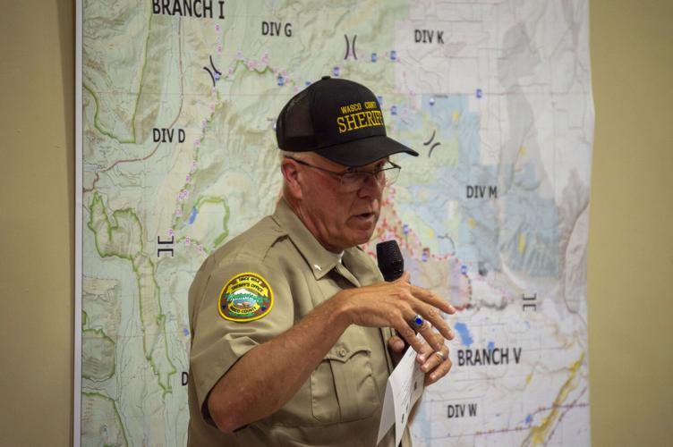
Wasco County Sheriff Lane Magill speaks at the Grasshopper Fire community meeting on July 31 at South Wasco County High School.
Nathan Wilson photo
“We started with nine when this thing happened, nine incident commanders,” said Wasco County Sheriff Lane Magill. “We went from nine to over 90. These guys are highly trained. I’ve worked with a lot of incident management teams over the years in major incidents like this, and these guys are dialed in.”
At the request of Jensen and Ruiz-Temple, Oregon Gov. Tina Kotek invoked the Emergency Conflagration Act last Wednesday to bring additional resources from outside the state, and she also announced that federal dollars will cover up to 75% of the Grasshopper Fire’s total suppression cost.
“This does create a lot of stress and fear in the community,” Chase Duncan, a state forester based in The Dalles, said to residents last Friday. “We have four of my firefighters who live in the community that are under evacuation and are still out on the line fighting the fire, so we understand.”
The Grasshopper Fire has closed multiple trails, recreation sites and roads in the Mt. Hood National Forest. More information can be found here. For evacuation notices, click here.









Commented