

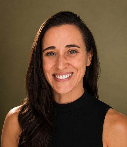
By Kate Bennett
On July 31, with a dozen fires burning across the state, Oregon’s insurance regulator issued an emergency order covering 45 zip codes under evacuation notice. The order required property and casualty insurers to suspend policy cancellations and nonrenewals, extend premium deadlines, and give evacuees more time to file claims.
Three days later, after the Spokane Complex fires destroyed roughly 700 homes, Washington Commissioner Patty Kuderer issued a similar order, extending the warning insurers must give before dropping a homeowner from 60 days to 120 and barring cancellations for missed payments.
Both orders are temporary: Oregon’s runs 30 days, and Washington’s expires September 30. Beyond those dates, neither requires an insurer to maintain a policy, nor limits what an insurer can charge when a policy comes up for renewal.
The state of California experimented with wildfire-related insurance moratoriums in recent years. After the 2019 and 2020 fire seasons, the state imposed moratoriums on non-renewals near fire perimeters. A Federal Reserve Bank of Dallas study found that non-renewals did fall during the moratoriums, but resumed the moment restrictions were lifted — possibly at a higher rate than in areas the moratorium never covered.
Ultimately, the California moratoriums provided a respite, but not a resolution. A moratorium governs when an insurer can drop you and how much notice it owes you, but not the calculation that flagged your property as an insurance risk in the first place.
That calculation has evolved substantially in the last few decades, and most homeowners have little to no insight into how their home’s wildfire risk is scored.
Obscure risk scoring
As local insurance agents told this paper in 2024, insurers once priced fire risk mainly by the rating of local fire departments. Today they overlay satellite-derived wildfire risk models onto individual parcels, scoring factors like vegetation density, slope, and proximity to past burns. Two houses on the same road can receive very different wildfire risk scores, and a homeowner rarely sees the score or knows which model produced it.
Insurers’ wildfire risk models — in the Gorge and elsewhere — are treated as trade secrets. During a California rate review in 2025, Allstate, rather than publicly release their wildfire model (developed by third-party ZestyAI), settled with the state, disclosing the premium dollars tied to each score rather than the model itself.
In Oregon, if wildfire risk drives your nonrenewal or your rate increase, your insurer is required to tell you which characteristics of your property caused it, and what mitigation work would earn a discount. Under Washington law, insurers owe you 60 days’ notice and their reason for refusing to renew. A Washington bill to make risk scores visible to homeowners passed the state Senate earlier this year, but has since languished in a House committee.
Even setting the risk models aside, there is no public accounting of what they have produced: how they impact insurance availability, coverage, and annual premiums. Insurance nonrenewals are the quiet version of this crisis; Kuderer’s office reports Washington nonrenewals have doubled since 2021.
That is a statewide count, and it says nothing about which properties or which scores. Whether the Gorge is tracking that trend, running ahead of it, or diverging by county and by state is, at the moment, unknown.
How this impacts the Gorge
I am a Gorge homeowner and a graduate student at Harvard, conducting research on how wildfire risk is reshaping homeowners insurance in our region. I have been trying to assemble that local picture: What has actually happened to insurance here in the last several years, and what we can expect in the years ahead.
None of it is public. Earlier this year, my public records requests for insurer coverage data in the Gorge were denied as competitively sensitive. Regulators publish statewide totals; insurers use proprietary models; and we still don’t know what actually happened, house by house, in our towns after Mosier Creek, Tunnel 5, Rowena, and Burdoin.
I am asking for your help. I am surveying homeowners across the Gorge, asking whether you’ve been dropped by your insurance provider, what you paid before the fires and what you have paid since, and whether you changed carriers.
Take the survey at this link, bit.ly/gorgesurvey, or by scanning the QR code. It takes about 15 minutes; responses are confidential and reported only in aggregate. As a bonus, you can choose to enter a drawing to win a $150 gift card to pFriem.
Information like this is usable: county planners can put it in adaptation and housing plans. Homeowners deciding whether defensible space work will pay for itself can weigh it. Legislators writing the next round of disclosure rules can cite it. And all of it is our data. Insurers have had it for years. This is how we get it back.
•••
Kate Bennett is a Gorge homeowner and graduate student at Harvard, where her thesis research examines how wildfire risk is reshaping homeowners insurance markets in the Columbia River Gorge. She has worked in sustainability for over a decade and is a founding member of White Salmon’s climate advisory board, for which she developed the city’s Greenhouse Gas Emissions Reduction Plan, as well as climate vulnerability and adaptation assessments.
•••
Participation in the survey is voluntary, responses are confidential and reported only in aggregate, and the study has been approved by Harvard’s Committee on the Use of Human Subjects, IRB Protocol #IRB26-0780.


Commented