
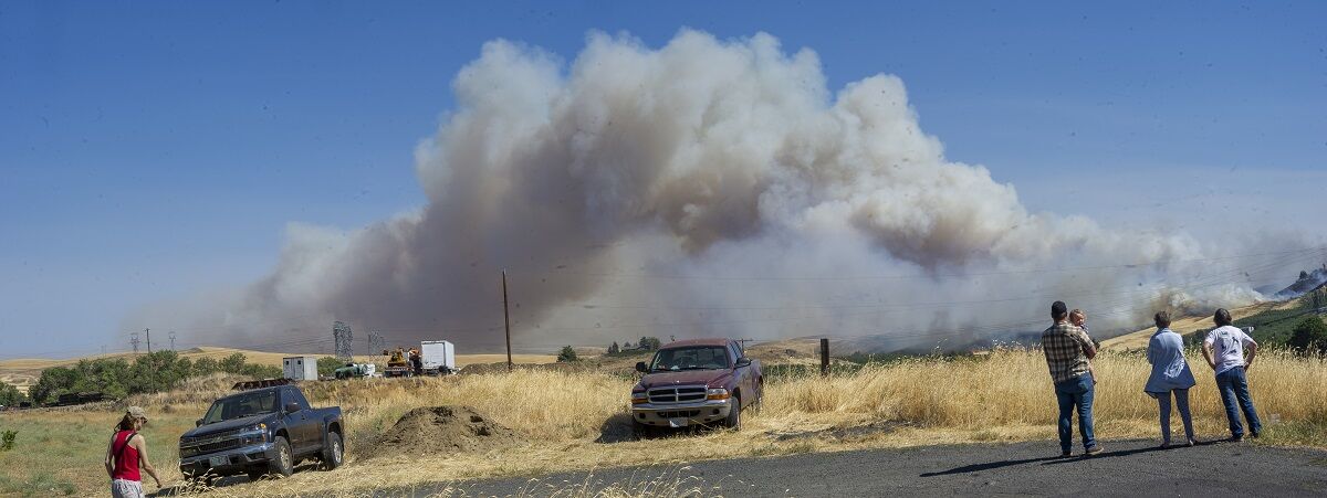

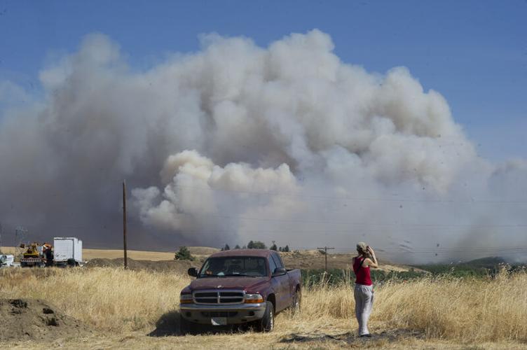
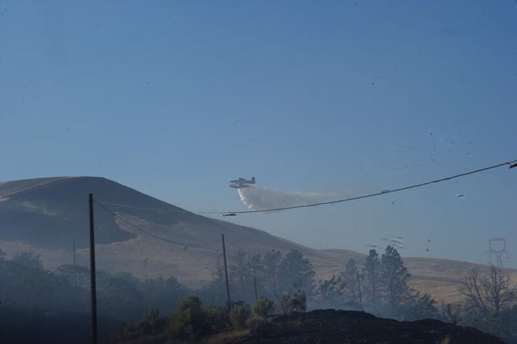


When the Valley View Fire (also called the Sunset Valley Fire) was first reported July 1, conditions where reminiscent of those facing firefighters during the Substation Fire of 2018. Both fires started within 1/2 mile of each other, were driven by high winds into dry fuels.
The Substation Fire fire consumed almost 80,000 acres in Wasco and Sherman counties, and destroyed four homes and four outbuildings. At its height, it was the nation’s “top priority” wildfire due to the number of at risk.
The Valley View Fire, in contrast, was held to 987 acres, damaged one barn, several outbuildings, multiple vehicles and a portion of a cherry orchard.
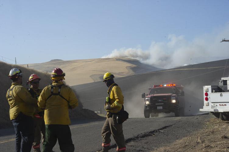
Mid-Columbia Fire and Rescue Chief Bob Palmer credited local response and the quick work of the Oregon Fire Marshall’s Office with the difference.
“Without the resources we had today, including the three additional task forces and air support from OSFM, we would not have stopped it as quickly and the fire would have grown much larger,” said Palmer. “What the state is doing is working. We were able to better protect properties with their assistance and support.”
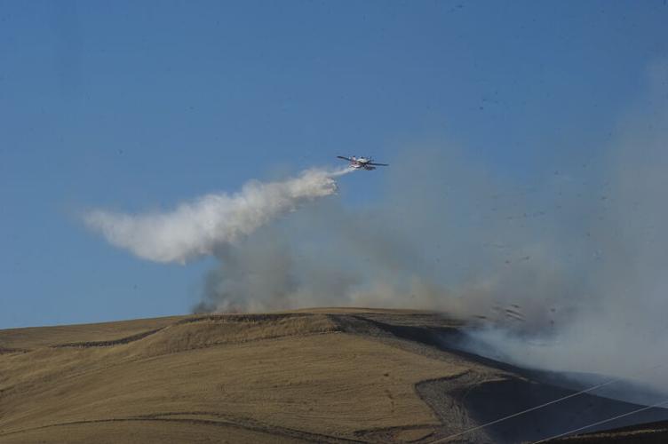
The fire, which was burning in mostly brush and wheat, was first reported around 3:45 p.m. on the 3100 block of Valley View Drive near The Dalles. Strong winds pushed the fire in a southeast direction, forcing evacuations and road closures.
Firefighters were able to protect the homes in the area and no injuries were reported.
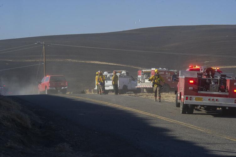
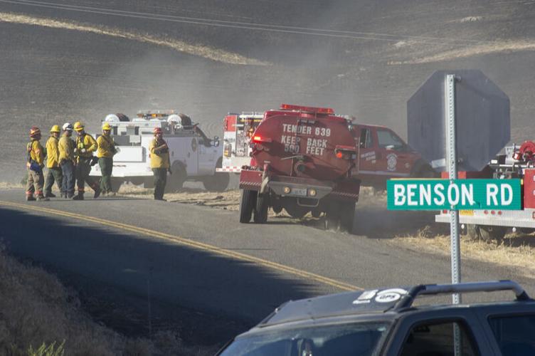
Mid-Columbia Fire and Rescue was the lead agency for the response. The Oregon State Fire Marshal temporarily reassigned task forces from the Wrentham Market Fire while coordinating air attack from Oregon Department of Forestry resources.
This decision, along with mutual aid from neighboring fire districts, was critical in stopping the rapidly advancing fire, according to the Oregon Fire Marshall’s office.
Parts of Highway 197 south of The Dalles were temporarily closed Thursday evening.
In all, more than 100 firefighters were part of the initial attack. Responding agencies included Mid-Columbia Fire, Dallesport Fire, Dufur Fire, Mosier Fire, taskforces from Multnomah, Washington, Yamhill, and Hood River, Bureau of Land Management, and the U.S. Forest Service.
The Dalles Police, Wasco County Sheriff, Oregon State Police, and Oregon Department of Oregon Transport also assisted on scene.
On Saturday, July 3, the state fully returned management of the fire to local control.
Taskforces from Marion, Yamhill, Multnomah and Linn Counties assisted in the initial attack and in mopping up hot spots, monitoring the perimeter of the fire, and expanding the defensible space around homes.
The Wasco County Sheriff’s Office issued several evacuations due to the fast-moving flames. County residents can sign up to receive future emergency notifications through the county.
The fire was originally mislabeled as the Sunnyside Valley Fire.
Rattlesnake Fire
According to a June 30 post on the Wasco County Sheriff’s Facebook page, a new fire near South Junction area, called Rattlesnake Fire, is burning towards Highway 197 and Jefferson County. The fire is burning near the intersection of highways 197 and 97, south of Maupin. A Level 2 Get Ready evacuation order is in place for residences near the Highway 197/97 intersection. The Rattlesnake Fire is not part of the S-503 reservation fire. Crews working the S-503 fire were diverted to the Rattlesnake Fire, and performed the initial attack.
As of July 4, the fire had consumed 5,479 acres and was 90% contained.
Wrentham Market Fire
Even as the Wasco County Board of Commissioners declared a “local state of emergency” June 30 in response to extreme heat —and banned fireworks in the county through July 14 — a brush and grass fire ignited the day before in the Dufur area, south of The Dalles, was reported to have grown to 10,000 acres in its first day.
The fire was declared a “conflagration” Wednesday morning, prior to the emergency meeting, which transfered management of the fire to the state via the Oregon Fire Marshall’s office.
Stefan Myers with the Oregon Fire Marshall’s office said the 3 task forces were coming from Yamhill, Multnomah and Washington counties and would provide ground and air attack as well as structure protection. He said 20 homes were threatened by the fire, which was being driven toward the Deschutes River.
“It’s not contained but they have some good fire lines dug in,” he said of the overnight work by local fire crews. He added that a barn had been lost overnight, but local crews had saved a home that was in “immediate threat.”
Three aircraft have been assigned to the fire, Myers added.
Sheriff Magill said the fire was held at Center Ridge Road overnight by local fire crews, but deep canyon fires and spot fires ahead of the fire were making containment a challenge.
“This is like the Substation Fire, with dry conditions and high winds anticipated,” he said. The 2018 Substation Fire was ignited in The Dalles and rapidly burned south clear into to Sherman County, burning four homes and four secondary structures, killing one resident and blackening 79,121 acres, many of them planted in wheat and ready for harvest.
Magill told the board three task forces en route that include overhead and incident command teams, and they will be fully operational very soon. He noted the teams responding including some of those who worked the Substation Fire.
“That’s an additional 100, 150 resources,” Magill said, which should allow a significant ground attack on the fire.
On July 2, the Bureau of Land Management (BLM) joined the Oregon State Fire Marshal (OSFM) in Unified Command of the fire.
“We’re really happy to have our partners at BLM joining us in supporting this community and taking care of business to contain this fire,” said Ian Yocum, OSFM incident commander. “The Unified Command structure allows agencies to better utilize expertise and position resources, and ultimately follow through on our mission of protecting life and property.”
BLM has activated two 20-person hand crews. They will arrive Thursday and will focus on areas with high concentrations of fuel and mopping up hot spots.
As of July 4, the fire had burned 7,222 acres and was 100% contained.
S-503 Fire
A Type-3 fire management organization lead by Incident Commander (IC) Travis Moyer was in command of the S-503 Fire. The S-503 Fire is located in timber and grasses on the Confederated Tribes of the Warm Springs Reservation and privately owned in-holdings protected by the Oregon Department of Forestry. This fire is being managed as a full suppression fire.
As of July 4, the fire had burned 6,822 acres and was 98% contained.


Commented