

Klickitat County’s Board of Commissioners elected not to wait for a state Court of Appeals to rule on its 2012 land use plan and zoning update for the lower White Salmon River valley.
Last Tuesday, May 26, the County Board voted unanimously to repeal the controversial plan and zoning update that has been the subject of litigation since 2013.
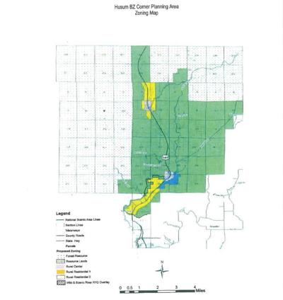
The County Board is expected to approve an ordinance later this month that makes the repeal official. It did not adopt a findings of fact on May 26 in support of its decision. That will come when the County Board moves to repeal the 2012 Husum/BZ Corner Sub-Area Plan and Zoning Update, as well as a historic — and controversial — settlement agreement between Klickitat County and the Yakima Nation concerning archaeological and cultural resource protection in the lower valley. The County Board put the guts of that legally binding agreement into the county code to give it effect under the administration of the Planning Department.
The County Board held a public hearing on April 23 in White Salmon to take testimony on whether to retain or repeal the current plan and zoning. Commissioners Rex Johns-ton (R-White Salmon), Dave Sauter (R-Lyle), and Jim Sizemore (R-Centerville) heard from landowners who objected to the settlement agreement on the grounds it changed the intent of the 2012 update, and from others who want the county to repeal the update and start over at the community level.
Johnston told The Enterprise on Monday that the County Board opted to repeal the plan and zoning update because “basically, we had a lot of people who objected to the settlement agreement and its leapfrog effect.”
Planning Director Curt Dreyer told The Enterprise in April, “The notion of ‘leapfrogging’ could occur if the archaeological survey reports required by the county per the settlement agreement indicate a proposed development cannot avoid an artifact or archaeological re-source. In such instances, the applicant would be required to obtain an excavation permit from DAHP [the state Department of Archaeology and Historic Preservation], which may or may not result in further investigation of [a site’s] eligibility.”
Johnston said the board was misinformed about the scope of impacts before it entered into the settlement agreement, which resolved the Yakama’s legal challenge to the 2012 update.
“It was our understanding there were only three [identified cultural resource] sites when we signed the settlement agreement,” Johnston said. “We had bad information on that. We thought all was fine until people tried to develop property in those areas. Unbeknownst to us, it wasn’t three sites; it was something like 30 sites. If you have property near one of those sites, you have to do a survey, and if you find more stuff, that makes it a new site.”
The problem, he explained, is that these identified sites receive protection from a radial 500-foot buffer that could overlap onto neighboring property and encumber it as well — the leapfrog effect.
The DAHP’s confidential data base lists 28 cultural resource sites in the county. Seven of those sites are listed as “determined not to be eligible.” Another four are listed as “potentially eligible.” The remaining 17 are listed as “inventory.”
“In administration [the settlement agreement], if an archaeological survey is required and artifacts are identified, and the landowner can adjust his development plans to avoid the identified artifact, that’s the end of the story,” Dreyer said, “and the county keeps the survey on file and it is not sent to DAHP. However, if impact to the artifact cannot be avoided, a permit from DAHP is required to move the artifact, collect data, and/or comply with other mitigation.”
Land use applications filed under the 2012 update are legally vested and unaffected by the repeal. Moreover, land use in the lower valley will revert to the plan and zoning in effect prior to June 2012.


Commented
Sorry, there are no recent results for popular commented articles.