Central Oregon Interagency Dispatch Center
FIRE NEWS--Central Oregon Interagency Dispatch Center

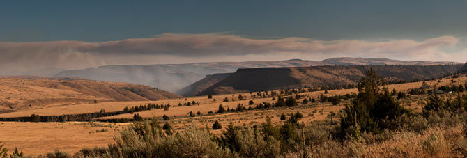
Light blue smoke, center, marks nearby burns in the Maupin area of the Deschutes River Canyon in this panorama created from multiple exposures. The long fire cloud in the background is from the Shaniko Butte Fire complex, which Maupin area fires are a part of.
Light blue smoke, center, marks nearby burns in the Maupin area of the Deschutes River Canyon in this panorama created from multiple exposures. The long fire cloud in the background is from the Shaniko Butte Fire complex, which Maupin area fires are a part of.
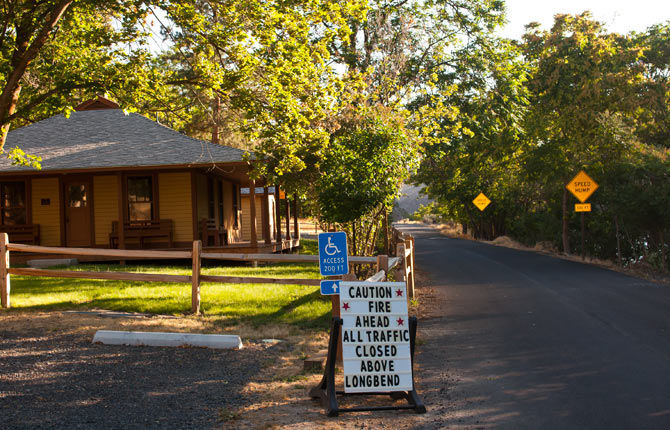
A sign at the Maupin upstream access point to the BLM Access Road along the Deschutes River warns of fire closures initiated Thursday, July 17 as a result of the Shaniko Butte Fire.
Central Oregon Interagency Dispatch Center
FIRE NEWS--Central Oregon Interagency Dispatch Center
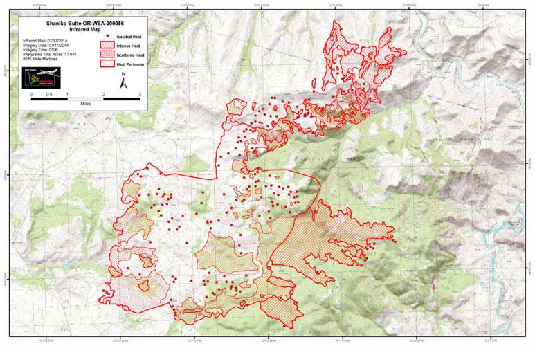
Central Oregon – The Shaniko Butte Fire was very active on Wednesday, growing to approximately 18,000 acres – and the wind and fire never let up through the night. This morning the fire made a run toward the Lower Deschutes River near the small community of Dant, and the west edge of the river.
In addition, the Ward Canyon Fire (#347), which caused the closure of Highway 97 north of Madras yesterday, is now backing down toward the east side of the Deschutes River.
Current and expected fire conditions have forced fire officials to make the decision to close the river to all day and overnight use between Trout Creek (River mile 88.5) and Long Bend (River Mile 57). Fire officials will evaluate this closure on a day-by-day basis and will lift the closure when it is safe.
Rafters can still float from Warm Springs to Trout Creek and can still use Segment 2 from Long Bend to Sandy Beach, as well as Segments 3 & 4 from Buckhollow to Heritage Landing at the mouth of the Columbia River.
Information from the News and our advertisers (Want to add your business to this to this feed?)


Sorry, an error occurred.
Already Subscribed!
Cancel anytime
Thank you .
Your account has been registered, and you are now logged in.
Check your email for details.
Submitting this form below will send a message to your email with a link to change your password.
An email message containing instructions on how to reset your password has been sent to the email address listed on your account.
No promotional rates found.
Secure & Encrypted
Thank you.
Your gift purchase was successful! Your purchase was successful, and you are now logged in.
| Rate: | |
| Begins: | |
| Transaction ID: |
A receipt was sent to your email.
Commented
Sorry, there are no recent results for popular commented articles.