THE GORGE — As winter approaches, one question is on everyone’s mind: Do I dress for rain or snow?
No need to play weather roulette, because the National Oceanic and Atmospheric Administration (NOAA) is predicting El Niño this winter. This event impacts all global atmospheric weather patterns and historically leads to warmer temperatures and less-than-average snow totals in the Columbia River Gorge.
While exact predictions can be complicated, Daniel Hartsock, meteorologist at NOAA National Weather Service in Portland, explained it all begins with the Pacific Ocean.
“The basic thing that’s looked for to predict El Niño is sea surface temperature anomalies across the equatorial region of the Pacific Ocean,” Hartsock said. “For an El Niño event, you’re looking at sea surface temperatures that are, on average, about a half a degree Celsius warmer than normal across the Pacific equator.”
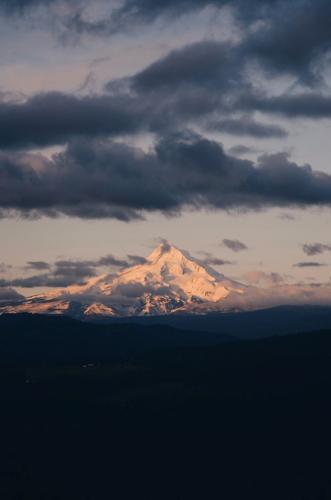
A snow-filled Mt. Hood Meadows during the 2022-2023 La Niña event.
Emma Renly photo
For La Niña, the opposite occurs and the surface temperature is colder than average. This was seen in the previous 2022-2023 winter that lasted until March; Mount Hood received 297.5 inches of snowfall and 76.2 inches of precipitation.
It’s also possible to have a neutral winter with no strong temperature abnormality, called El Niño Southern Oscillation (ENSO) neutral.
Hartsock added that strong El Niño events are usually correlated to 1.5 to 2 degrees Celsius above normal sea surface temperatures. NOAA measures in four different regions across the Pacific Ocean, with the latest forecasts predicting more than 55% chance of a strong El Niño from January to March 2024.
There is also a 35% likelihood the event will become historically strong from November to January, which means the sea surface temperatures measure above 2 degrees Celsius.
So how does the temperature near the equator of the Pacific Ocean influence weather patterns across the globe?
“Near the equator is the convergence of a lot of wind coming from the north and south,” Hartsock explained. When the sea surface temperatures increase, trade winds decrease.
“Typically during normal sea surface temperatures, trade winds blow from east to west across the Pacific equator,” Hartsock said. “During El Niño years, those winds weaken and sometimes may even turn westerly.”
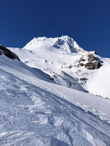
The north face of Mt. Hood during March in 2023.
Emma Renly photo
With the weakened trade winds, the warmer surface air over the ocean doesn’t get pushed west as strongly. Instead, it rises upwards, influencing the location of the jet streams in the upper atmosphere, which typically follow the boundaries of hot and cold air.
There are four major jet streams — two in the northern hemisphere and two in the southern hemisphere. These narrow bands of strong winds blow from west to east, transporting weather systems across the landscapes.
Across the United States are two: The Polar Jet Stream, situated further to the north, and the Pacific Jet Stream, which flows to the south.
“When El Niño impacts the Pacific Jet Stream, it brings that jet stream further south, which produces the wetter and colder temperatures across the southern United States,” Hartsock said. “In turn, that kind of draws the moisture away from us in the Pacific Northwest — this includes most of Canada and into Alaska, where it’s typically warmer than the average winters.”
NOAA Climate Prediction Center has come out with its three-month outlook that discusses temperature and precipitation. From December 2023 to March 2024, there is a 50-60% chance of above-normal temperatures in the Pacific Northwest.
“While there’s a strong correlation between El Niño and warmer than normal temperatures, winter precipitation is a lot more uncertain,” Hartsock said. “The Pacific Jet Stream, while typically amplified across the southern United States, can swing up to the north. There is some uncertainty there.”
The outlook for precipitation from NOAA Climate Prediction Center currently shows equal chances for above, below or near normal precipitation amounts.
“Snowfall totals on Mount Hood will depend on elevation,” Hartsock said.
Two of the lowest snowfall years in the past 70 winters were during strong El Niño events: 2004-2005 received 99 inches of snow, while 2014-2015 received an even lower total at 71.6 inches, according to the weather station at Government Camp.
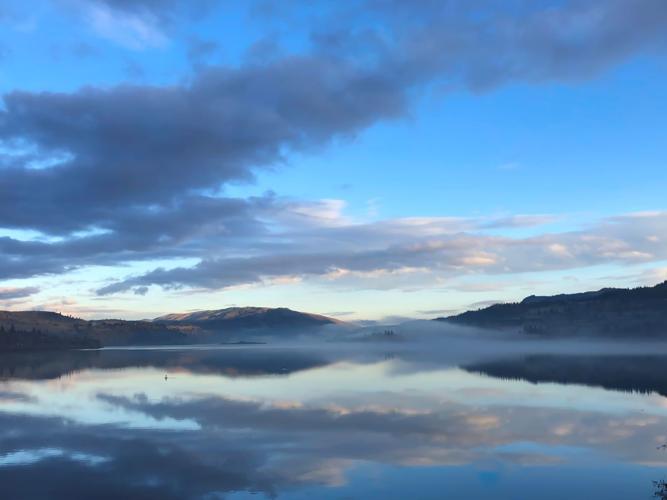
A misty morning across the Columbia River Gorge.
Emma Renly photo
“There is an impact on the amount of snow totals due to Government Camp’s elevation level, in what I believe is partly due to climate change. The higher up you go on Mount Hood, the less of an impact,” Hartsock added.
He noted that historical data points to a more even amount of snow during El Niño events in the 1950s and 1960s, which differs from current trends. Over the next century, NOAA Research estimates that extreme El Niño and La Niña events will increase in frequency and amplitude due to human-triggered greenhouse gas emission, affecting the global atmospheric pattern.


Commented