


Hiking the short Hood River Pipeline Trail is to cross paths with history, stewardship, nature and modern art all mixed together into a unique, 2.8 mile adventure.
The out-and-back trail (officially the Hood River Penstock Flume Pipeline Trail) begins at the Powerdale Substation just upstream from downtown Hood River, with access via a short paved (mostly) access road off Highway 35 an estimated 1/2 mile from Interstate 84.
Trailhead parking is at the former Powerdale Substation. The now-defunct substation was built in the early 1900s. The first dam on the river was built in 1909, and was replaced around 1920. It generated about 6 megawatts of electricity, enough to power about 3,000 homes. Electricity generation ended when sections of the pipeline connecting the upstream dam to the powerhouse were destroyed in a 2006 debris flood, and in 2010 the dam, fish facility, intake structure, power canal, steel flume and sand settling basin at the project’s upstream location were removed.
According to a 2019 report in the Hood River News prior to removal of the dam, the diversion pipeline, which channeled water from “Copper Dam” to the powerhouse three miles downstream, took 500 cubic feet per second of water away from the river. During low-flow summer months, that amounted to up to 80%of the river flow diverted into the pipeline. With significantly reduced water levels, river temperatures in the three mile stretch between the dam and the powerhouse were at times elevated above accepted state standards.
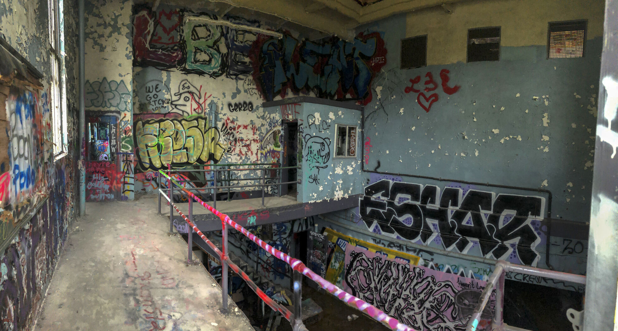
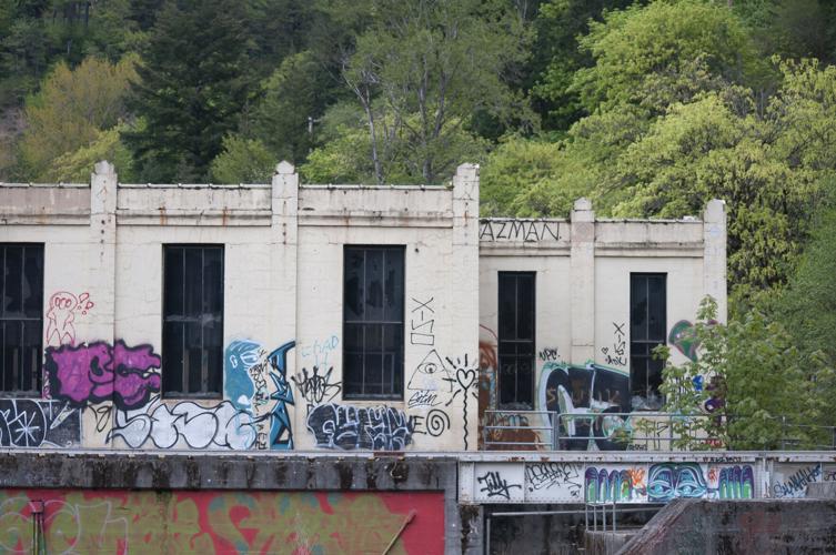
Access to the historical powerhouse is “unofficial” (the door locks are busted, as are all of the windows) and inside and out the structure is now a colorful testimony to the creativity, mischievousness and daring of a host of graffiti artists.
Inside, you will be hard pressed to find an unpainted surface. The art, surprisingly, is for the most part lacking the common vulgarities one often finds in such locations. Not to say the building is child friendly — glass and debris are piled throughout. Call it art, call it vandalism or criminal mischief, there are a host of stories covering the walls.
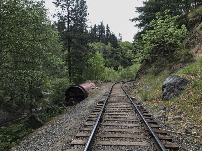
The trail begins just upstream from the powerhouse, skirting the railroad tracks for a short distance before branching off to more closely follow the Hood River.
The river
The Hood River, formerly known as Dog River, flows approximately 25 miles from its headwaters on the East Fork to its confluence with the Columbia River near the city of Hood River, according to Wikipedia. The the river descends from wilderness areas in the Cascade Range on Mount Hood and flows through the agricultural Hood River Valley. It rises in three separate forks on the north side of Mount Hood, within the Mount Hood Wilderness in Hood River County. The mainstem river is approximately 10 miles long.
The maps of the Lewis and Clark expedition show the Hood River under the name Labeasche River after Francis Labiche, one of the expedition’s members. In the mid-19th century pioneer era, a party of starving travelers resorted to eating dog meat. As a result, the Hood River became known as the Dog River. This name was unpopular. A pioneer resident of the area, Mrs. Nathaniel Coe, was able to change local usage to Hood River, after Mount Hood. The name Hood River appeared on maps as early as 1856. The older Dog River name became attached to a lesser tributary of the East Fork Hood River, from which the City of The Dalles draws a portion of its water supply.
In an article by Alix Danelsen, published January 2021 in “The Osprey, The International Journal of Salmon and Steelhead Conservation,” the author describes the 339-square mile Hood River Watershed, its tributaries fed by five glaciers, as having “one of the most diverse assemblages of anadromous and resident fish in Oregon, including spring and fall Chinook, summer and winter steelhead, coho, Pacific lamprey, bull trout, sea-run and resident cutthroat trout, rainbow trout, mountain whitefish, large scale sucker and two species of sculpin.
“The high diversity is largely due to the watershed straddling the transition zone between fish populations that reside either west or east of the Cascades,” Danelsen writes. “In fact, the Hood River is one of only five Oregon watersheds to have indigenous populations of both summer and winter steelhead. Another factor is the very cold water flowing from the watershed’s high-elevation tributaries, making it one of 14 cold-water refuges along the Lower Columbia River.”
The trail
Just how cold is the Hood River? It’s easy to find out as the pipeline trail heads upriver, with many short trails branching off to access sand and rock beaches along the river. Although there is plenty of evidence of the old pipeline — a few sections of pipe and many large concrete supports remain — the river itself has been flowing freely since the dam, about four miles upstream, was removed in 2010.
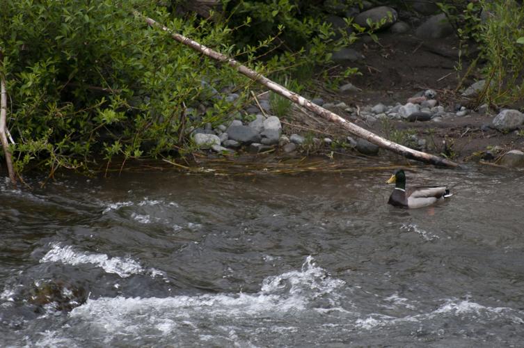
For a little over half its length (.8 miles) the trail hugs the riverbank. Just to the east, across the railroad tracks, a series of ponds provide a now-rare wetland habitat for beaver, waterfowl and other wildlife.
There have been efforts to, in the future, relocated the railroad tracks closer to Highway 35, out of the floodplain, to increase the wetlands in the Hood River watershed.
For a portion of the lower trail a rock island is visible, it’s upstream edge piled with debris, including burned timber. A debris flood in 2006 washed out the upper portion of the pipeline, taking the dam out of service and ultimately resulting in its decommissioning as a power generator.
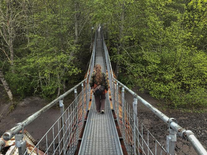
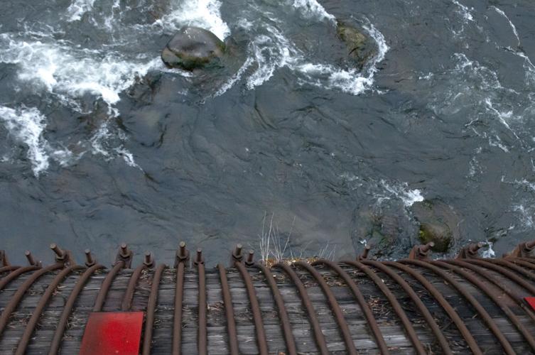
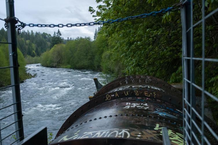
A few sections of the pipeline can be found along the lower trail, but the most unusual portion of the trail begins as the original pipeline emerges from the ground and crosses the Hood River.
A narrow service walkway, set atop the pipe, arches up and over the river. Steel grid flooring (very hard on dog paws) and handrails carry the hiker over the river, then continues upriver for a little over half a mile (.6 miles). A dozen feet or more above the ground, this is a unique, elevated walk through the rich deciduous forest bordering the river.
Several access points allow the hiker to descend to the river from the elevated pipeline, but for the most part the hiker is confined to the trail, completely hemmed in by the hand rails; passing oncoming hikers requires a fair amount of grace.
The trail ends abruptly where the pipeline was destroyed by the 2006 flood.
If you go
The trailhead: Take Interstate 84 exit 64, following signs for Oregon 35 (Mount Hood Highway). At the end of the offramp, turn south on Oregon 35 toward Government Camp and Mount Hood. Continue .5 miles on Hwy. 35, and make the next right down Powerdale Road.


Commented
Sorry, there are no recent results for popular commented articles.