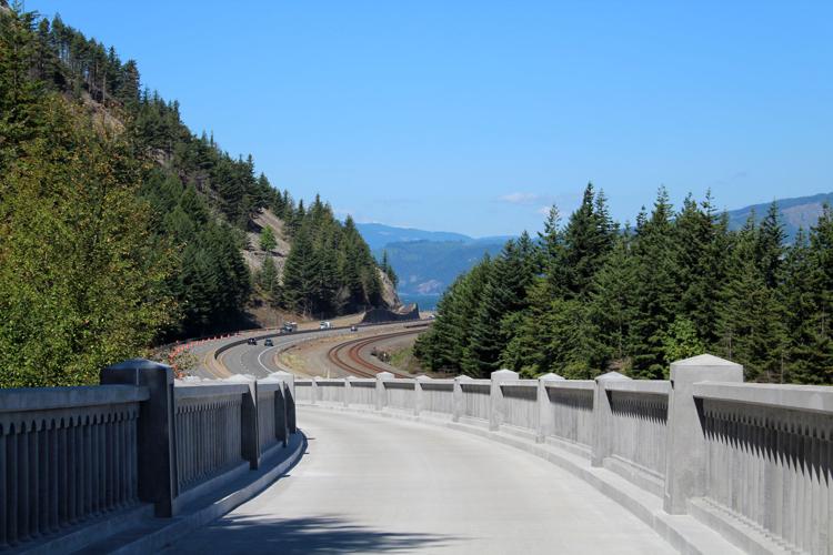
Summit Creek Viaduct looking westward down the trail, which runs parallel to I-84. Crews used 1,592 pre-cast railing pieces and 43 pre-cast columns to build the guardrails on either side of the viaduct.
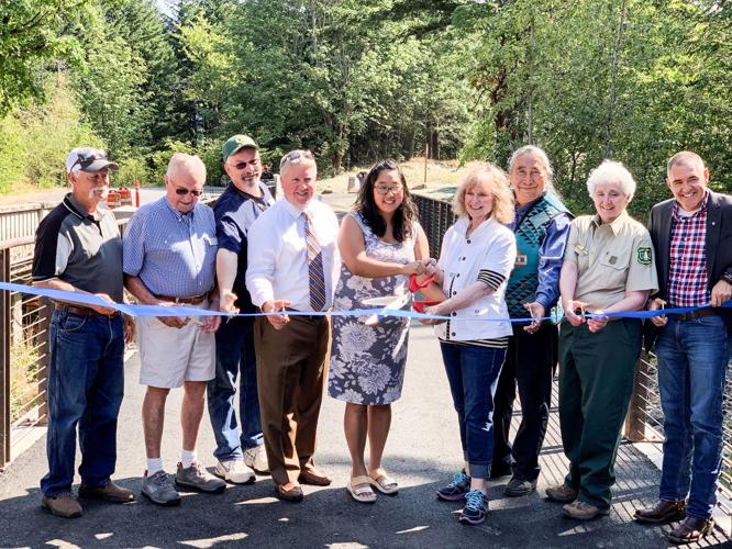
Gathered for the ribbon cutting are Mike Oates, Hood River County Board of Commissioners, left; Bill Pattison, Historic Highway Advisory Committee; State Rep. Chris Gorsek, Dist. 49; Rian Windsheimer, ODOT Region 1 manager; Caroline Lipps, owner Thunder Island Brewing Co.; Lynn Orr, executive director of the History Museum of Hood River County; Louie Pitt, Confederated Tribes of the Warm Springs; Lynn Burditt, U.S. Forest Service area manager; and MG Devereux, Oregon Parks and Recreation Department.
Summit Creek Viaduct looking westward down the trail, which runs parallel to I-84. Crews used 1,592 pre-cast railing pieces and 43 pre-cast columns to build the guardrails on either side of the viaduct.
Emily Fitzgerald
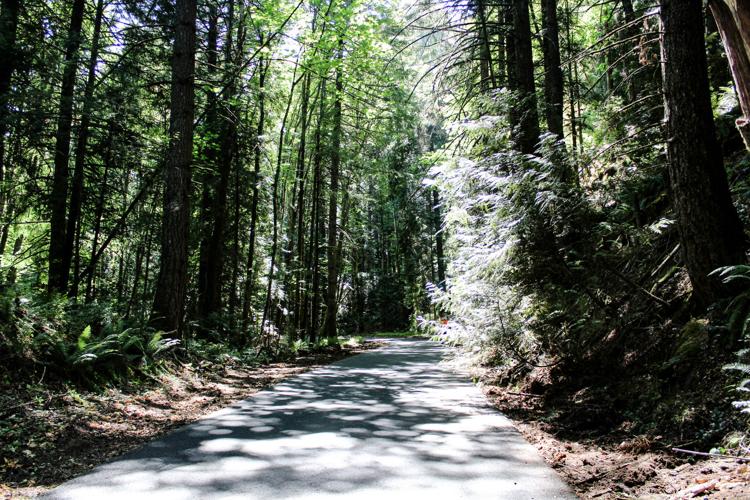
A section of trail called the “mossy road" follows the original alignment of the historic highway.
Photo by Emily Fitzgerald
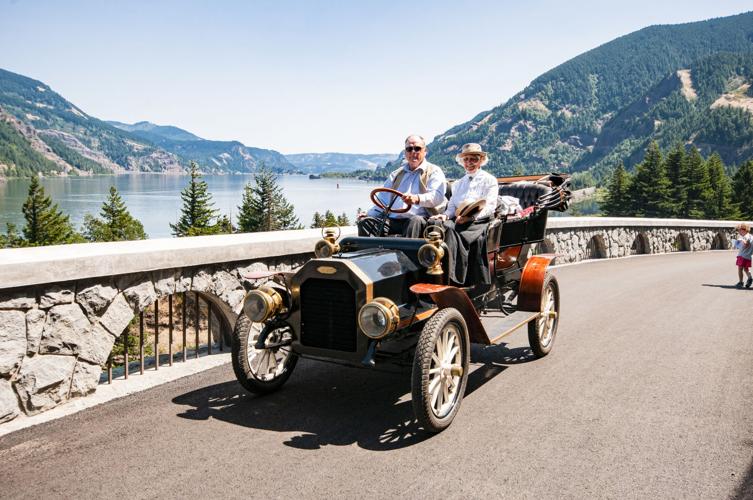
Hikers, cyclists and vintage cars plied the newly-opened three-mile section of Historic Columbia Highway Trail near Wyeth on Aug. 3.
Photo courtesy of ODOT
Gathered for the ribbon cutting are Mike Oates, Hood River County Board of Commissioners, left; Bill Pattison, Historic Highway Advisory Committee; State Rep. Chris Gorsek, Dist. 49; Rian Windsheimer, ODOT Region 1 manager; Caroline Lipps, owner Thunder Island Brewing Co.; Lynn Orr, executive director of the History Museum of Hood River County; Louie Pitt, Confederated Tribes of the Warm Springs; Lynn Burditt, U.S. Forest Service area manager; and MG Devereux, Oregon Parks and Recreation Department.
Three more miles of the Historic Columbia River Highway State Trail are finished, and will be open to the public following an official grand-opening on Aug. 3.
The new segment begins at the Wyeth Trailhead and goes alongside the original alignment of the Historic Columbia River Highway to Lindsey Creek.
The ribbon cutting opens the new segment of trail as well as the new trailhead, which includes a bike repair station, restroom and water station.
ODOT will be hosting the ribbon cutting at 10 a.m. on Saturday, Aug. 3, after which the trail will be officially open to the public. The trailhead is located off of I-84, exit 51, and can be reached via the Columbia Gorge Express.
The completed segment is part of a larger project to reconnect the Historic Columbia River Highway, originally constructed between 1913 and 1922. Designed by lawyer/entrepreneur Samuel Hill and engineer Samuel Lancaster, the highway was intended to put people in touch with the natural beauty of the Gorge, and project managers have paid special attention to honoring this intention and preserving the aesthetic of the original highway.
“We spent a lot of time and we spent a lot of energy to make sure we’re doing this in a deliberate manner,” said Terra Lingley, ODOT’s program manager for the Columbia River Gorge.
The original highway fell out of use in the 1960s after I-84 was built, but when the Columbia National Scenic Area was created in the late 1980s, ODOT, along with the Oregon Parks and Recreation Department, State Historic Preservation Office and Travel Oregon, was charged with preserving, enhancing and reconnecting the original highway.
That task proved to be a challenge, said Lingley, because I-84 interrupted key sections of the old highway. The trail follows the original alignment of the old highway whenever possible, but ODOT had to get creative with its trail design to bridge some of the gaps created by I-84.
Rock blasting was enough to create space in some areas, while others required more creative solutions — one of which is the Summit Creek Viaduct, accessible in the newly-opened segment of trail. The 500-foot-long-structure moves the trail away from the rockface and is held up by five concrete arches built directly beside I-84, with an outcrop for people to get off the trail and take in the view. “It’s the design details that make this structure special,” Lingley said. “It (the concrete) will continue to age, and we designed it to look old … and kind of mimic the design aesthetic of the original highway.”
When the project is complete, 73 miles of the old highway will be accessible to the public; of those, 51 will be open to vehicle traffic, and 22 will be completely vehicle-free.
Construction on the three-mile segment cost approximately $22 million and took nearly two years to complete. With this segment complete, ODOT has only five more miles of the Historic Highway State Trail to complete: 1.5 miles at Mitchell Crossing, which will include a recreation of the Mitchell Point Tunnel, expected to start construction in 2020; 2.6 miles between Mitchell Creek and Viento State Park, expected to start construction in 2021; and about 1.6 miles between Ruthton Park and Hood River.
Funding has been secured for everything except the final 1.6 mile section, which will cost an estimated $40 million.


Commented
Sorry, there are no recent results for popular commented articles.