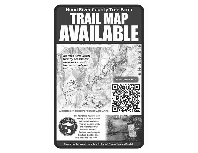
HOOD RIVER — Hood River County has announced the development of the new Hood River County Tree Farm Trail Map, a user-friendly, interactive web map of recreational trails in the county forest. The platform allows users to visualize and gain information about the recreational trail network.
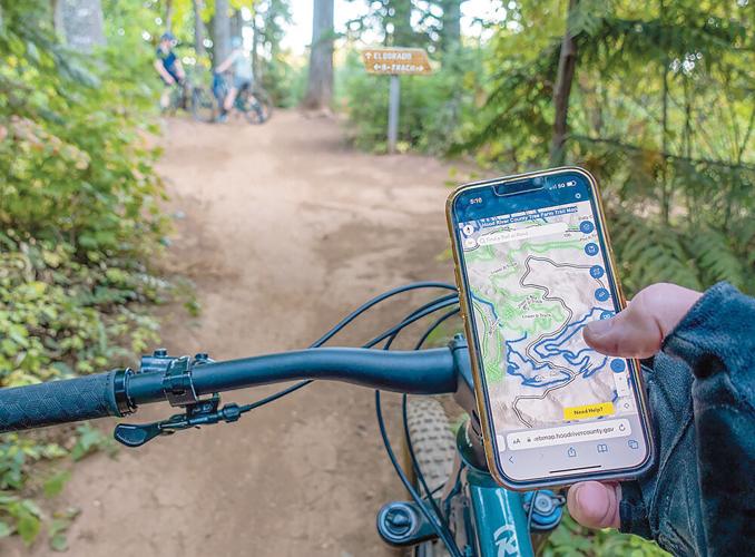
The Hood River County Tree Farm Map app can be accessed even while out for a ride and hike.
Photo courtesy Hood River County
More than 230 unique recreational trails in the county forest are used by mountain bikers, hikers, equestrians, off-highway vehicle and 4x4 riders and adaptive bicyclists, said a county press release.
“The tool makes it easier to identify trail access points and difficulty ratings, and determine trail statuses,” continued the press release. “The new online map enables Hood River County Forestry staff to update trail information in real-time. This will improve safety and awareness for all trail users and help with communications for natural disasters.”
Users can access the Hood River County Tree Farm Trail Map at webmap.hoodrivercounty.gov/trail or scan a QR code on signs at staging areas. The map is compatible with all web-enabled devices, including desktop computers, tablets, and mobile devices.
The web map was developed by Hood River County’s Geographic Information Services (GIS) in collaboration with the county forestry department. The county’s GIS provides spatial data and geographic information to the public on Hood River County and its surrounding area. Hood River County has offered GIS services for 25 years, which includes a collection of hardware and software for managing, analyzing and displaying various forms of spatial data such as zoning, roads, aerial photography and topography.
Jake Edwards, the county’s GIS coordinator, manages a wealth of data and provides analysis specific to this region and county, said the press release, adding the county’s GIS system is constantly evolving to meet the needs of residents and county staff. Additional features for the web map are in development by the county, including an option for offline map viewing when poor cellular service is an issue.
“The map is interactive,” said Edwards. “So, if you want to know more about a trail, road, or staging area, you can click on a map feature. A pop-up window will display detailed information including links and photos. For more information about web map tools, click on the ‘Need Help?’ button, and a User Guide will provide details on tool functions.”
Recreationalists in the county who want to know their location can click on the “Find My Location” tool. This function will use a device’s internal GPS location to place a blue dot on the map to mark a location.
•••
As a reminder, annual county forest parking permits are required to park in Fee Parking Zones. The permits are only for parking and are not needed for entry, recreational use, or accessing county property. Annual permits cost $30 and are transferable and daily permits cost $5. Permits are available at select local vendors, while online purchases include small transaction fees.


Commented