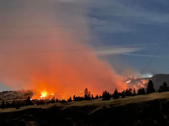
Valerie Fowler, Klickitat County representative on the Gorge Commission who lives just east of Catherine Creek, captured this photo of the Top of the World fire Oct. 15.
Valerie Fowler, Klickitat County representative on the Gorge Commission who lives just east of Catherine Creek, captured this photo of the Top of the World fire Oct. 15.
Valerie Fowler, Klickitat County representative on the Gorge Commission who lives just east of Catherine Creek, captured this photo of the Top of the World fire Oct. 15.
Valerie Fowler, Klickitat County representative on the Gorge Commission who lives just east of Catherine Creek, captured this photo of the Top of the World fire Oct. 15.
Valerie Fowler, Klickitat County representative on the Gorge Commission who lives just east of Catherine Creek, captured this photo of the Top of the World fire Oct. 15.
Valerie Fowler, Klickitat County representative on the Gorge Commission who lives just east of Catherine Creek, captured this photo of the Top of the World fire Oct. 15.
Valerie Fowler, Klickitat County representative on the Gorge Commission who lives just east of Catherine Creek, captured this photo of the Top of the World fire Oct. 15.
Valerie Fowler, Klickitat County representative on the Gorge Commission who lives just east of Catherine Creek, captured this photo of the Top of the World fire Oct. 15.
KLICKITAT CO. — The U.S. Forest Service said in a news release Oct. 16 that the Top of the World fire, located on National Forest System land west of the Catherine Creek recreation area, had grown to 240 acres. Forward progress was stopped in the early hours of Oct. 15, the release said.
There was no update as of 2:30 Oct. 17.
“The Top of the World Fire resulted from a planned prescribed burn that was initiated on Oct. 14 as part of continuing efforts to reduce hazardous fuels and improve forest health surrounding the popular Coyote Wall and Catherine Creek trail systems,” said the news release. “Following a shift in wind direction and an increase in wind gusts, the fire spotted outside the burn unit.”
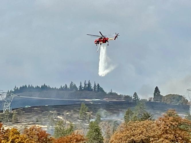
The release said that, while the fire remains on National Forest System lands between Bingen and Lyle, Klickitat County Fire Districts, Washington State Department of Natural Resources, Oregon Department of Forestry and Mid-Columbia Fire and Rescue responded to help contain the fire. On Oct. 15, an airtanker was ordered to minimize spread towards Old Highway 8, State Route 14, and private properties to the south and west of the fire. There were no structures threatened and no evacuations ordered.
The public is asked to avoid the area surrounding the popular Coyote Wall and Catherine Creek trail systems as firefighters are actively working in the area. Smoke will remain visible from Washington State Route 14 and Interstate 84.


Commented