

The Oregon Department of Forestry recalled the use of its wildfire risk map on Thursday, Aug. 4, after public criticism that the online tool is causing home insurance rates to increase or not be available at all.
The Department of Forestry removed the current iteration of the wildfire risk map from its online Oregon Explorer tool and withdrew notices to property owners in extreme and high-risk classifications.
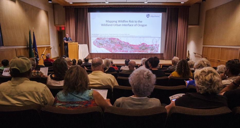
Property owners in Wasco county were among those offering criticism of the risk map and how their properties were classified during a public meeting at Columbia Gorge Discovery Center hosted by the map’s creators on Wednesday, Aug. 3.
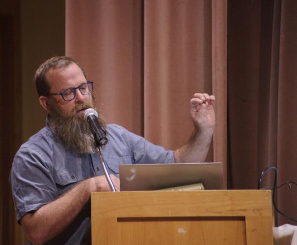
By way of introduction, Tim Holschbach of the Oregon Department of Forestry’s protection division based in Salem, told the crowd of over 100 residents attending that the Oregon Department of Financial Regulation, which regulates the insurance industry, is monitoring the process very closely.
“The governor’s office and that department are watching this very closely for any changes,” he said. “Any changes or terminations (by insurance providers) that are that are either perceived or articulated to a customer as due to the map, that’s actually against the law,” he said, drawing homeowner’s attention to a report form sent to those in high and extreme risk categories. The financial regulation department can than follow up with an investigation and enforcement action, he explained.
“They’re watching closely to make sure insurers are not abusing what was this product is intended to be,” he said.
Cal Mukomot, the director of the Oregon Department of Forestry, said in a release Thursday, “We will immediately begin working with Oregon State University on some refinements to improve the accuracy of risk classification assignments based on what we’ve heard from property owners thus far.”
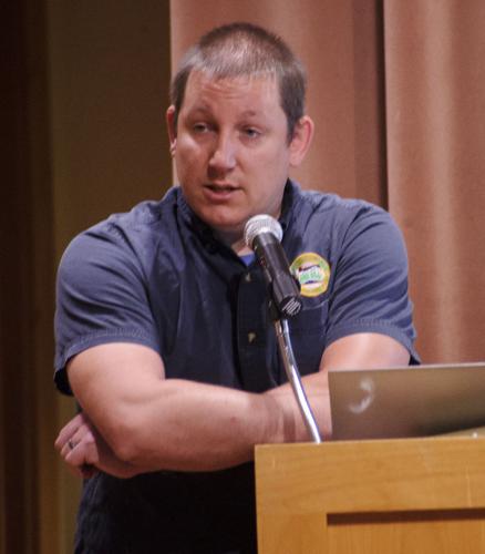
Speaking Wednesday, Dr. Christopher J. Dunn of Oregon State University said the timeline for creating and publishing the map, and the 90 day comment and appeal period, was set by the Oregon legislature.
The Department of Forestry was assigned to develop and maintain the statewide wildfire risk map following the 2021 passage of Senate Bill 762.
Passage of the bill allowed the Department of Forestry to make investments in fire-adapted communities, wildfire response and the development of wildfire resilient landscapes — 11 state agencies were tasked with developing various components of the bill.
Oregon State University helped develop the mapping tool.
The purpose of the map is to identify the risk of a wildfire occurring in a given area to help determine where resources are needed most to protect lives and property, said Mukumoto.
The agency was also tasked with defining the wildland-urban interface where development meets combustible vegetation. It assigned a risk classification at the property ownership level for all 1.8 million tax lots across the state. Each parcel was placed into one of five categories of wildfire risk — none, low, moderate, high or extreme.
Property owners in the high or extreme risk categories were suddenly faced with the potential prospect of new regulations, under development by the Oregon Fire Marshal, including special building codes and fire-safe landscaping. Tonkon Torp LLP, a Portland-based law firm that reviewed the legislation, said the regulations impacted around 120,000 tax lots statewide, including 80,000 structures.
According to Mukumoto, the current appeals process will end and any appeals filed will become moot. “For those who did submit an appeal, we will be reviewing the information submitted and using it to identify any additional areas where we may need to take a closer look at the data,” he said.
Speaking in The Dalles, Holschbach said, “Most folks in this room that live in this area know the battles that this area has, there are large wildfires pretty routinely. And most folks either have manicured yards or have done defensible space around their home to clean up their brush.” Those homeowners will already be in compliance with the new guidelines, he said. “Fire wise communities, that’s all in line with what the codes requirements are,” he said.
Existing homes will not be impacted by any fire-related code changes, he added, as those involve new construction.
The Senate bill tasked other state agencies with developing new codes for defensible space and home hardening to increase resiliency in the event of a wildfire, including the fire marshal’s office.
Firewise USA is a national program that encourages neighbors to work together and take action to prevent damage from wildfires.
•••
David Gilmore, a real estate agent with Coldwell Banker Bain in Bend, said the bill has made the challenge of buying a home even more difficult than it was, especially in high-risk areas. He had a client recently who was buying a home in Sisters and was initially denied insurance coverage. Gilmore later found a broker in Redmond that would insure the home.
“There’s definitely more talk about insurance now. This is one more potential hurdle homebuyers and sellers need to be aware of,” said Gilmore. “The map doesn’t necessarily take into account if a neighborhood is a Firewise neighborhood or not.”
Statewide, around 2,000 Oregonians gave feedback to the agency since the release of the wildfire risk map in July, much of it concerning the risk classification.
•••
Prior to the recall of the map, on Aug. 3, state Sen. Lynn Findley (R-Vale) co-wrote a letter to ODF requesting the map be withdrawn. “The intent behind Senate Bill 762 was to mitigate future significant loss, lack of preparedness and financial hardship in future wildfires, among many other things. Oregonians have been handed anything but that through the new map,” said Senator Findley, who has over 32 years experience in Fire and Aviation management.
“Pulling back the maps and pausing the process has had executive level and bipartisan legislative level support. The Oregon Department of Forestry had a chance to restart the process and blatantly chose not to do so.”
At The Dalles’ meeting, state representative Daniel Bonham (R-The Dalles) encouraged those attending to call him, saying that his office was prepared to help residents navigate the appeal process.
Despite the public anger over the bill, others maintain the spirit of the law was correct and only needs fine tuning.
“The state may not have gotten the methodology right in these first drafts of wildfire risk maps. But the risk maps and wildfire hardening requirements mandated under SB 762 are urgently needed to save lives and property from future wildfires,” said Deschutes County Commissioner Phil Chang.
The agency’s decision does not impact the code development and adoption processes that are underway through the Office of the State Fire Marshal for defensible space or the Building Codes Division for home hardening.
Mukumoto admits in the statement that the agency did not have enough time for public outreach ahead of the deadline for delivering the map. He said the map will be reposted and new notices sent, starting a new appeal period.
“We are in the process of developing a plan and timeline to complete these activities, including public engagement and outreach opportunities,” said Mukumoto. “We will share that publicly as soon as it is complete.”
Michael Kohn, Oregon Capital Bureau, contributed to this report.


Commented
Sorry, there are no recent results for popular commented articles.